The Ghost in the Machine: Why "Googling" Information on Lake Superior is Getting Harder

Look, I love maps of all kinds. But lately, my Facebook feed has been cluttered with what I can only describe as “AI-generated junk.”
You’ve seen them: maps with iconic sites in the completely wrong places.


I’m sure you’ve also seen fake viral photos, whether it is the “sinkhole” photos that claim massive whirlpools are opening up near Thunder Bay or fake and blatantly wrong photos of fake sandstone arches in the Apostle Islands or waterfalls in Wisconsin that look nothing like the real thing.
Even the National Weather Service fell victim to a bot-hallucination in 2025, releasing a map that included town names like “Orangeotilld” and “Whata Bod.” It would be laughable if it weren’t so wasteful. It’s digital noise that clutters our understanding of the places we love.
And it’s even worse when we go searching for actual content. Whether you’re looking for a summer expedition itinerary or weekend inspiration, there is a sinking feeling when you realize the article was written by a bot—or by someone who has never actually felt the spray of the Big Lake.


The issues here go deeper than annoyance. AI-generated content is damaging for three major reasons:
1. Historical Erasure
When stories are simplified for “clicks,” we lose the nuance of the “Deep Map.” We lose the stories of labor history, the complexities of the fur trade, and the millennia of stewardship by the Anishinaabe and other Indigenous peoples. Instead, we get “surface stories” recirculating again and again the same facts about a shipwreck or famous white male politician while ignoring the thousands of years of human life that came before.
2. Physical Impact on the Landscape
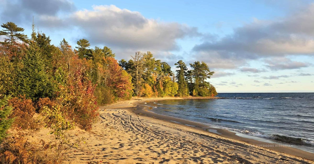
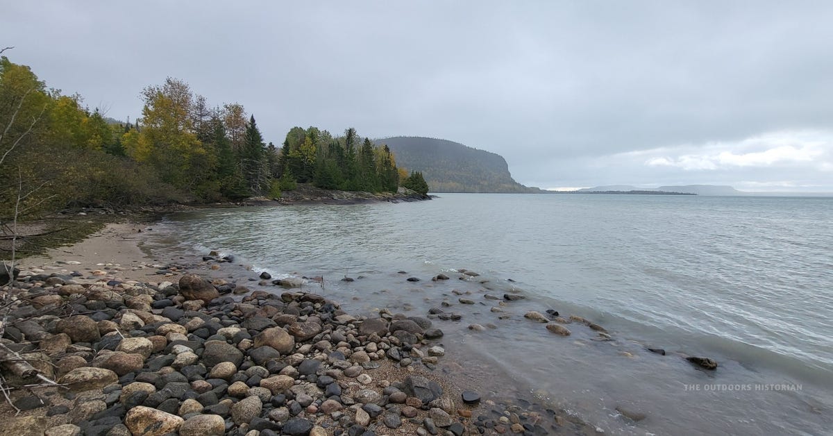
AI loves a “soft life.” It generates images of Lake Superior that look like a turquoise Mediterranean postcard—sun-drenched, calm, and serving pina coladas. But a bot doesn’t understand a November gale or fragile ecosystems.
We’ve seen what happens when people who don’t understand local impacts promote a “hidden gem” without context. Primare examples are Sawpit Bay in Ontario, which is now closed to the public, and Paradise Point in the UP, which is now only accessible by water to protect the private property and sensitive shoreline. When a bot tells thousands of people to visit a spot that has no infrastructure, it isn’t “sharing a secret.” It’s causing trail erosion, littering, unsafe parking, and a massive strain on local emergency services.
3. The Lack of “Provenance”
As a historian, I’ve been trained to treat information like an artifact. You don’t just look at it; you check its provenance. I track where the information comes from, who is circulating it, and who that information serves. AI generated information has no provenance. It is a “copy of a copy,” stripped of the accountability that comes from real-world expertise.
The Three Pillars of a Vetted Source
If you want to practice “Landscape Literacy,” you need high-quality sources. Here is how I vet the sources I use for my own research:
Pillar 1: The “Primary” Check. Does this source cite legitimate physical or digital archives? I treat info like an artifact. You wouldn’t find a rusty tool in the woods and guess it’s a Viking sword; you’d check the metal, the location, and the layers of soil around it. If a blog post says “History says...” without pointing to a land record or a digitized map, why treat it any differently?
Pillar 2: The “Indigenous Peoples” Check. If a narrative starts the clock in 1850 or 1900, it’s not just missing the “beginning”—it’s missing the entire foundation. A vetted source acknowledges the long-term stewardship of the Anishinaabe and other Indigenous peoples. If the first few thousand years are “missing,” the information is biased at best.
Pillar 3: The “Contextual” Check. Does it take into account recent research by leading experts and the lived experiences of the community? A vetted source doesn’t just look at a map; it listens to the people who have been in the watershed for generations.
Why I Do the Hard Work
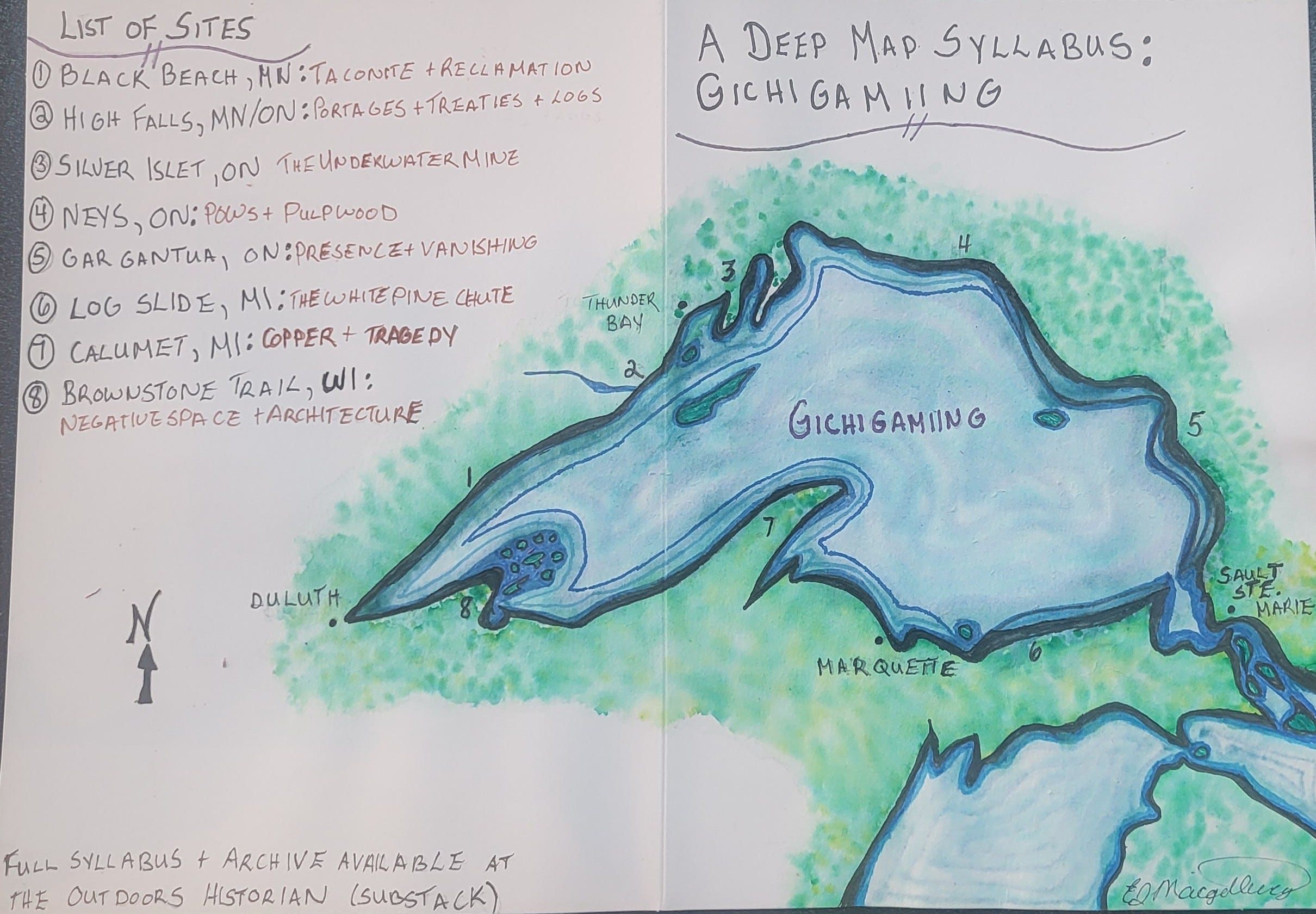
History is complex. That’s why I use a Deep Map Methodology. For me, landscape literacy isn’t just a hobby; it’s a rigorous practice. I look at every place through six distinct lenses:
The Architecture of the Land (Geology)
The Deep Green (Forest Ecology & Natural History)
Indigenous People & Nations
The Industries of Extraction (Logging & Mining)
Maritime History (Shipping, Shipwrecks & The Network of Rescue)
From Spectator to Steward
When a bot scrapes the internet, it might catch a glimpse of one of these layers. But it can’t see how they interconnect with one another like an ecosystem.
And while my social media posts might not get thousands (or even hundred) of “reactions” like the AI-generated slop, the comments and messages I get from real people make it worthwhile to me.
Why I Created the Curated Resource Library
I’ll be honest with you: even with a PhD, sometimes I get overwhelmed by the “infinite scroll.”
There are nights where I’m searching for info and I realize I’ve spent 45 minutes just weeding. I’m filtering out ‘top 10’ lists written by creators who couldn’t find the Chequamegon Bay on a map—let alone pronounce it correctly. And look, I have a lot of grace for the humans who trip over those vowels. I’ll be the first to admit I botched the pronunciation during an academic job talk when I first moved to the region. It’s a mouthful, and learning to say it correctly is part of building a real relationship with this place. But while humans struggle with heart, AI just fills the space with junk. If a bot can’t even get the vowels right, how can we trust it with the history?
Landscape Literacy requires high-quality sources. You can’t read the layers of time if the map you’re using is blurry.
I realized a while ago that I had been building a “private sanctuary” for myself—a collection of bookmarks, digital archives, and vetted books that I return to whenever I need to get my facts straight. Because I know how exhausting it is to vet everything yourself, I decided to open that sanctuary to you.
I’ve put together The Deep Map: A Curated Resource Library—a 15-page free PDF guide to the books, maps, and digital tools I actually trust. These are the sources that helped me write my books and build the Northland Collaborative. No junk, no “hallucinations,” just the real story of the Big Lake.
Next time you’re out on the trails or paddling the shoreline or wandering the sidewalks of a downtown street I hope you have the right “map” in your hand—one that respects the past and protects the future of the watershed.
Have you seen any AI-generated junk recently that you want to rant about? Sound off in the comments! I’d love to commiserate with you.
AI-slop is affecting everything all at once. It’s disheartening to hear this from your perspective. I could rant all day against the spread of disinformation.
A great read, thank you for sharing. This is a very important topic and a common discussion in my social circle right now. AI is providing misinformation, and its discouraging to see the number of people blindly trusting it without critical thought or further research. Especially because the number one global search platform provides an AI summary as a highlighted answer, people just take it as truth.