The Deep Map Methodology I Use When Exploring the Northwoods
Read the Landscape to Move Beyond the Postcard for a Meaningful Travel Experience

I wrote this in mid-May, with the ice long gone from the inland lakes near the South Shore of Lake Superior, and the 'Deep Green' is just beginning to wake up. It’s the perfect time to start reading the layers before the summer crowds arrive.
Most of us are navigating the world using what I call the “Flat Map.” The Flat Map is the one provided by your GPS, your highway signs, and the glossy tourist brochures at the rest stop. It is a two-dimensional world of “points of interest” and “estimated time of arrival.” It tells you exactly where you are, but it is remarkably silent on why you are there or the complex histories of the places you visit.
When we only rely on the Flat Map, we are at risk of becoming algorithm-driven travelers—bouncing from one highly-rated photo-op to the next without ever touching the true story of the place. We see the 'Best 10 Views' but miss the 1.1 billion years or more of history that carved them. Or, we pull over at the scenic overlook, snap the photo, and leave without realizing our boots are standing on the pages of a story we haven't even begun to read.
As a historian, what interests me is the “Deep Map” of the Northwoods. While the Flat Map gives you the 2D coordinates, the Deep Map gives you the 3D verticality and illustrates the web of interconnection. It allows you to look through the pavement and the “pristine” forest to see the layers of cooling basalt, the centuries of Indigenous diplomacy and sovereignty, and the industrial skeletons of the ‘White Gold’ timber rush—so named because the massive white pines were the primary wealth of the 19th-century North.
If you missed my last post, we dipped our toes into three of these layers, explored why most people miss them, and learned how to find them.
3 Things Most People Miss on a Lake Superior Circle Tour (And How to Find Them)

For many, the Lake Superior Circle Tour is a bucket-list achievement—1,300 miles of rugged shoreline, golden beaches, and that impossible, ocean-like blue. We pack our cameras, mark the famous overlooks, and prepare for a collection of “pretty views.”
Today I’m focusing on how these layers are part of my larger 6-Layer Deep Map methodology I use to navigate Lake Superior because traveling without a framework is like reading a book where you only understand every fifth word. You see the shapes of the letters, the spaces between the paragraphs, and the "pretty" font, but the plot—the actual soul of the story—remains a mystery.
To move from being a spectator to a steward of the Northwoods, you need a way to read the whole page and make connections between the pages. You need strategies that turn every road trip into an exploration and conversation with the land. That’s why I’m showing you how to dive into the Deep Map for yourself.
Why 6 Layers?
These are the foundational layers I use to understand the Deep Maps of the Lake Superior watershed and the adjacent Northwoods. They are the collective themes that have emerged from spending a lifetime traveling in the watershed and over fifteen years researching and teaching about it.
These layers are not linear: they are stacked, tangled, and pulsing with life. They are a multilayered, webbed ecosystem. Think of them like a healthy forest. There is a deep layer (the microbes, roots, and mycorrhizal networks in the soil), the "short" vegetation of the forest floor, the "medium" vegetation of the shrubs and young trees, and the "tall" vegetation of the mature canopy.
Across these stacked layers are vital connections—the movement of water, fungal networks, and wildlife that strengthen the whole. Just as a bird might eat fruit from a flower in the understory and spread the seeds to a new ridge, or how a river transfers sediment and rocks from the inland interior to a delta at a river mouth, the stories of the Northwoods move between layers.
When you understand the system, you stop seeing just a "pretty view" and start seeing a dynamic conversation that gives life to the beautiful scenery.
Field Historian’s Note: Don’t let my ecology metaphors scare you. You don’t need to be a biologist to use this framework—I’m not one. You just need to start observing the world around and realize that when you change one layer, you vibrate the whole web.
The 6 Layers of the Deep Map
For each layer of the Deep Map, I am going to include a photo from the northwestern Wisconsin stretch of the Lake Superior Circle Tour to show how you can apply all of these layers whether you are exploring one section or doing an entire circumnavigation of the Big Lake.
1. The Architecture of the Land (Geology)
The Designation: The Basement
This is the deep timeline of geologic events that eventually created the Great Lakes. The ancient Canadian Shield forms the foundation. Then, 1.1 billion years ago, the Midcontinent Rift pushed layers and layers of magma to the surface, creating the basalt ridges of the Keweenaw Peninsula, the Minnesota North Shore, and northwestern Ontario. The weight of the lava created the Superior Syncline (a bowl shape), which collected layers of sediment that eventually formed Jacobsville Sandstone. Later, the entire landscape was sculpted by glaciers. The geology is the foundational stage upon which every other story is built.

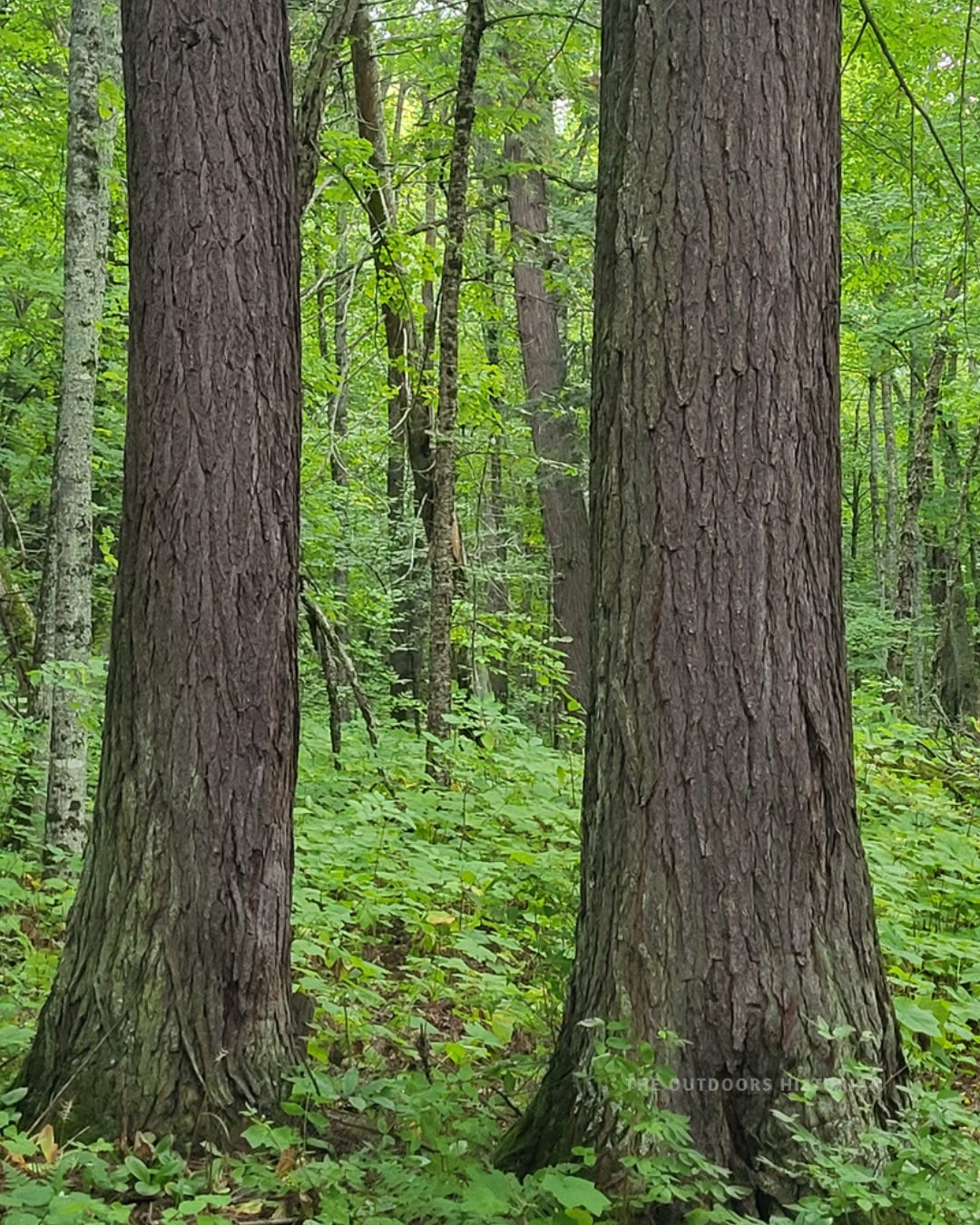
2. The Deep Green (Forest Ecology & Natural History)
The Designation: The Covering
If geology is the foundation, the forest is the covering. This layer focuses on the vegetation that grows from the soil and the rock. In particular, this layer focuses on the transition from the Boreal forest of the North Shore to the Mixed Hardwood (Mesic) forests of the South Shore, where the red clays and sands support a "Deep Green" of Sugar Maple, Yellow Birch, and Hemlock. Engaging with this layer means becoming attentive to these transitional shifts, and recognizing the forest’s relationship with the "Basement" layers beneath it and human layers above it.


3. Indigenous People & Nations
The Designation: Sovereignty Across Generations
Since glaciation, Indigenous peoples have called the Great Lakes home. Along with being home to the Anishinaabe, the watershed has also been a place of home and refuge for the Dakota, the Cree, the Menominee, the Wendat (Huron), and others. It has always been a vital center of ecological diversity, political alliances, and diplomacy.
One important focus of this layer is seasonal rounds—land practices grounded in the specific time of year that were long used to sustain Indigenous communities. Some of these practices were specifically reserved in 19th-century treaties by the ancestors of today’s Anishinaabe Nations, like hunting and fishing. After a century of being criminalized for practicing these rights, courts eventually recognized them in landmark decisions in the second half of the twentieth century.
To read this layer is to move beyond the “wilderness” myth and acknowledge the enduring political sovereignty and treaty law that defines the watershed today.
 photo of the brown and white National Park Service sign for the Apostle Islands Little Sand Bay Visitor Center. Below the English text, the Anishinaabe name \"Zegashkiigadaawangaag\" is clearly displayed on a sign along the wooded Little Sand Bay Road.")
4. The Industries of Extraction (Logging & Mining)
The Designation: The Industrial Scar & Legacy
This is the layer where humans harvested the rocks and the trees. The architecture of extraction is carved into the land by the “White Gold” logging era and deep veins of copper, iron, and silver. It is visible everywhere, from the crimson iron-ore harbors to the dark, copper-rich basalt of the Gay Stamp Sands to the submerged silver shafts of Silver Islet. By mapping the historic flow of timber and ore, we see the physical blueprint of industrial triumph and eventual transition. While today’s forests might feel “pristine,” in most parts of the Northwoods they are actually healing scars—the legacies of massive reforestation labor required after the timber rush.

5. Maritime History (Shipping, Shipwrecks & The Network of Rescue)
The Designation: The Hydraulic Connection
For centuries, Gichigami has functioned as both a highway and a hazard. This layer examines the “Hydraulic Connection”—the sophisticated systems built to move wealth across an unpredictable inland sea. This wealth came from the natural resources of the region: timber, taconite, copper, silver, gold, and more. It also highlights the Network of Rescue: the interconnected grid of lighthouses, fog signals, and life-saving crews who stood watch over the ships carrying the valuable goods.
 photo of the sleek, white modern Michigan Island Lighthouse in the Apostle Islands. The lighthouse tower rises from a vibrant green tree line behind a strip of sandy beach and blue Lake Superior water.")
6. From Spectator to Steward
The Designation: The Synthesis
The final layer is the evolution and transformation of the traveler. The Synthesis is the shift from consuming a pretty view to working to understand a complex place. It’s not a destination, but a practice. It begins the moment you stop simply “driving the loop” and start participating in the life of the lake. By un-layering the Deep Map, you become a steward of the land’s interconnected stories. In this way, your understanding of how the past affects the present directly informs your actions today.
Lest you think this methodology only applies to my backyard in Wisconsin, you can apply it anywhere across the watershed. Take Marathon, Ontario, for example.

The town is several miles south of Highway 17 and has commanding views of a harbor that was once a prime fishery for the Anishinaabe. Just a few miles east of the turn-off is the Gchi-Waaswaaganing Cultural Center, run by the Biigtigong Nishnaabeg Nation (Pic River First Nation). The name means “Place of the Big Lake of Torches,” which refers to the traditional practice of spearfishing by birch bark torchlight.
Marathon’s name also reveals information about its layered past. Originally called Peninsula, the nearby town was renamed “Marathon” in the 1940s when the Marathon Corporation, a Wisconsin company, built a massive mill on the harbor. The mill closed in 2009 and is now largely demolished. It is another chapter in the boom-and-bust story of the Lake Superior watershed.
Marathon is an example of how the wealth of the Canadian Boreal forest (Layer 2) was once harvested and dispersed south to markets in Wisconsin, leaving behind the “concrete ruins” of a paper mill in Marathon as the remains of that massive industrial movement (Layer 4). All of this occurred in the traditional and contemporary territory of Anishinaabe people (Layer 3). Today, much of Marathon’s economy is tied to gold mining (Layer 1 and 4).
In the Northwoods, the closing of a mill or a mine isn’t just an end; it’s the beginning of a new chapter of the Deep Map. My point is not to minimize the loss, but instead to show that historically, these changes are also opportunities for a community to experiment with shifting to sustainable economies.
How to Use the Framework in the Field
Next time you are in the field, try using these four prompts. If you aren’t used to identifying these layers, you may need to do some “research” in advance by looking up information about the different layers (Hint: you can find helpful resources in my Deep Map Library!). Then, practice spotting the physical evidence on the trail:
Look Down: Identify the rock (Layer 1) and see what’s growing on it (Layer 2). Do you notice connections or patterns between the two?
Look Around: Identify the "networks" you see evidence of. This includes both natural plant communities and human infrastructure (Layers 2, 3, 4, and 5).
Look Through: Acknowledge the names and history beneath the surface. Replace "Flat Map" labels with "Deep Map" stories—Indigenous place-names, industrial lineages, and maritime networks (Layers 3, 4, 5, and 6).
Look For Help: Seek out historical markers, exhibits, or local guides. Remember that signs (especially older ones) may not tell the entire story of a place, but they often provide a helpful initial nugget of knowledge.
The Ultimate Field Demo
To see how this works in practice, let’s look at a single, specific shoreline on the South Shore. Here’s exactly how I apply this framework at a site like the one pictured above near Gay, Michigan on the east side of the Keweenaw Peninsula.

First, I Look Down and notice: this isn’t natural beach sand. It’s crushed dark basalt from the historic Gay Stamp Mills on the east side of the Keweenaw Peninsula—a direct byproduct of copper mining industry, which illustrates Layer 4 (Extraction).
Next, I Look Around and notice how there is a total lack of typical dune vegetation (Layer 2) in this man-made “desert.” The forest only begins at the very edge of the dark sands.
Then, I Look Through and acknowledge that this shoreline was once the roaring “engine room” of Copper Country. I think back even further to realize this was home to the Anishinaabe for millennia before the mills arrived, and that they continue to fish these waters today. This prompts a deeper question: How do these toxic stamp sands affect underwater fish spawning grounds, and how does that environmental degradation affect the human communities relying on those fish today?
Conclusion: The Reward of Depth
This 6-layer framework is not a list of facts; it is a way to develop your own understanding of the watershed and the landscapes you visit. It is the methodology I use to see connections throughout the watershed from the billion-year-old basalt to the contemporary sovereignty of Anishinaabe Nations.
When you travel this way, the "boring" stretches of highway—the long miles between the famous waterfalls and the gift shops—become engaging chapters of the book. Suddenly, a roadside rock cut is a window into the Midcontinent Rift, and a secondary forest is a map of the Industries of Extraction. You are no longer just driving; you are un-layering. You are moving from Spectator to Steward, and history begins to shape how you act in the present.

Take the Methodology into the Field
Ready to apply this to your next road trip or day hike in 2026?
Download my free The Deep Map: A Curated Resource Library. It includes the field kit essentials, the 'Deep Map' definitions, and the specific resources I use to un-layer the Northwoods for myself.
What’s your favorite place to dig into the Deep Map of the Northwoods? I’d love to hear about it. Let me know in the comments!
I love this piece. ...your methodology is brilliant. 😊