The Circle Tour Series Part 6: The Architecture of Sand and a Classroom With No Walls
How 1,300 miles of 'stacked maps' turned a career transition into a new syllabus of the land.

Welcome to The Circle Tour Series. In Fall 2024, my partner, Eugene, and I circled Lake Superior. We left our home in Bayfield, Wisconsin, and headed clockwise up the Minnesota North Shore, crossing the border into Ontario. Then we drove along the Ontario shore before crossing the border at Sault Ste. Marie and traveling through the UP to return home. Most of our time was spent between Sleeping Giant Provincial Park and Pukaskwa National Park.
Part travelogue, part history, this series explores the intersection of industrial ruins, boreal ecology, and personal transition. It is a journey to see how landscapes survive when the systems built upon them—including mines, railroads, and careers in higher education—fall apart. This is Part 6 of 7. You can read Part 1 here, Part 2 here, Part 3 here, Part 4 here, and Part 5 here. This is the narrative conclusion. Next week, we’ll dive into logistics.
When we crossed the International Bridge into Sault Ste. Marie, Michigan to finish up our final section of the Lake Superior Circle Tour, we didn’t just cross a political border; we crossed a geological and psychological threshold.
Ahead of us lay the final stretch to drive. Behind us lay the Ontario North Shore—a landscape of 2.7-billion-year-old granite and the ‘ghosts’ of industries like Jackfish and Gargantua. As I explored in Part 5, those towns were reminders of the fragility of systems built for individual profit, and how easily they collapse when the ecology shifts.
Crossing the border is also an important reminder of how the watershed is the homeland of Anishinaabe people. Whenever I travel across the border in the Great Lakes, I try to remind myself how this imaginary line was created and imposed on the land. For the Anishinaabe, this place is known as Baawitig (or ‘place of the rapids’) and it was never a border. It was a hub. Long before the International Bridge or the Soo Locks, this was a place of deep diplomacy and shared kinship. Crossing here reminded me that while I was moving from one settler-colonial jurisdiction to another, I was still traveling through Anishinaabe homelands that ignore the line on the map. I delve more into the history of Sault Ste. Marie in some of my other posts.
Ozhaawashkodewekwe and The Treaty of Sault Ste Marie

Ozhaawashkodewekwe (also known as Ozhaguscodaywayquay and Susan Johnston) was born into an esteemed Anishinaabe family in the early 1770s. She spent her childhood in the western end of the Lake Superior watershed, moving between the Chequamegon Bay and hunting grounds northwest of the lake.
We had taken a gamble on finding a room for the Saturday of a holiday weekend, but after several anxious phone calls on our drive, we secured a modest room on the Michigan side of the border. It wasn’t the Ritz. But after nine days in a tent, a climate-controlled room and a hot shower felt like ultimate luxury.
We celebrated our first night not cooking on a campfire with a margarita and a booth at Applebee’s. After nine days living in the boreal forest, stepping back into a corporate chain felt like a strange re-entry into the very systems I’d been critiquing all week. It was a reminder that we all navigate the 'fragile systems' of modern life—sometimes for a paycheck, and sometimes just for a basket of chips and a cold drink. But as I sat in that booth, I wasn't just a tired camper anymore; I was a researcher who had finished her first week of fieldwork. I was happy, I was fed, and for the first time in months, I was feeling good about my direction.
Lattes and Locks
The next morning, Eugene finally got what we had been yearning for: a latte and crepes at Oh Crepe downtown. Sitting there with a proper latte, he looked like a happy man.


Sitting at Oh Crepe, we were just steps away from the Soo Locks—the mechanical heart of the entire Lake Superior extraction system. It’s impossible to ignore the layers of history here. Long before the first lock was built in 1855, this was the site of the St. Marys Rapids, a place where Anishinaabe people gathered for millennia to fish and conduct diplomacy.
The construction of the locks in the mid-nineteenth century didn’t just bypass the rapids; it signaled the decisive shift from the fur trade to the boom-bust industries we had been tracking for 1,300 miles. Once the locks opened, taconite from the Minnesota North Shore and copper from the Keweenaw Peninsula could be ground down and shipped out at an industrial scale. The locks were the gateway for the timber, the iron, and the copper that built the very “modern systems” I had been critiquing at Applebee’s the night before.
Standing there with my own latte, I realized that while the International Bridge represents a political threshold, the locks represent a structural one. The locks were a project of re-engineering the water to serve the extraction of the land and make the Lake Superior watershed accessible to industry. They are the "drain" through which the wealth of the north was funneled to the cities of the south.
A Thematic Bookend at Pictured Rocks
Ahead of us lay the South Shore: a land of sandstone, shifting dunes, and the familiarity of home. But as we left Sault Ste. Marie, we weren’t ready to pull into the driveway in Bayfield just yet. The weather was holding, and I knew there was one final ‘thematic bookend’ waiting for us in the eastern half of Pictured Rocks National Lakeshore: the Log Slide. I didn’t realize at the time that this final stop would be an important moment in my own personal journey.
The Log Slide was an ideal narrative anchor because it connected to the multiple sites we visited while tracing the map of extraction on our Circle Tour.
At Black Beach, we stood on the waste of the iron industry.
At High Falls, we saw remnants of a log flume used to transport logs to Lake Superior.
At Silver Islet, we stood on the shore, looking out to where the world’s richest silver mine was—briefly—before the lake took over.
At Jackfish, we stood on the ruins of the coal docks.
At Neys, we stopped at the mouth of the Little Pic River and saw the logging cleats in the bedrock shore.
At Pukaskwa, we found the rusted boom chains at Hattie Cove—reminders that even the ‘Wild Shore’ was once a site of massive pulpwood extraction.
At Gargantua, we stood on a cobble beach near the “ghosts” of the commercial fishery.
Now we were heading to the Log Slide in the Grand Sable Dunes, where in the second half of the nineteenth century, towering white pines and other conifers were clear-cut from the interior, dragged to the slide, and sent down a wooden chute to the lake below where they were rafted to mills. Hardwoods weren’t logged until railroads reached an area, because unlike conifers, hardwoods don’t float and can’t be transported by waterways.
The Cutover Era emerged in the Northwoods after land cession treaties, like the 1836 Treaty of Washington, transferred these forests from Anishinaabe control to the US government. The timber was the prize for states like Michigan, but for the Anishinaabe, the treaty was a survival strategy to maintain their connection to their traditional territory.
The Treaty of Washington in 1836

On this day in history, the Treaty of Washington was signed in 1836. This treaty was between federal officials and Anishinaabe leaders in the eastern Upper Peninsula and the northern Lower Peninsula of Michigan.
Adding Layers: The Map of Sovereignty
Land cession treaties are one part of the story, but it’s also important to remember that the 'Deep Map' I’d been reading for 1,300 miles wasn't just made of iron, copper, and logging. It was held together by the names and the stories of the people who have stewarded this water since long before the first surveyor’s line was drawn and these extractive industries took hold. This map also traced our route:
High Falls (Grand Portage): This 120-foot drop is the physical reason for Kitchi Onigaming (The Great Carrying Place). This 8.5-mile portage was the vital link that allowed the Anishinaabeg—and later the fur trade—to bypass the unnavigable lower Pigeon River.
Mount McKay (Animkii-wajiw): Known as “Thunder Mountain,” this sacred site on Fort William First Nation stands as a silent witness to the shift from deep diplomacy to the industrial grit of Thunder Bay.
Silver Islet & Nanabozho: The oral histories of the Sleeping Giant aren’t “folklore”; they are the geological archive of the region. The story of Nanabozho being turned to stone to protect the silver is a direct commentary on the ethics of extraction.
Neys & Intersecting Histories: During WWII, the Canadian government used this isolated stretch of shore for internment camps. To “see” Neys is to recognize how settler-colonial states often repurpose Indigenous lands as sites of confinement.
Pukaskwa (Manitou Miikana): A living classroom for Traditional Ecological Knowledge (TEK). From managed boreal forest fires to its proximity to the Biigtigong Nishnaabeg, Pukaskwa is a model for modern Indigenous stewardship.
Lake Superior Provincial Park: From the spiritual gravity of the Agawa pictographs to the reclamation stories of the Batchewana First Nation, this park reminds us that the “Wilderness” was always a home.
Baawitig (Sault Ste. Marie): Long before the locks, this was the focal point of Anishinaabe diplomacy, and continues to be home for Anishinaabe communities on both sides of the international border.
Mashkiiziibii (Bad River): As we crossed back into Wisconsin, we saw the white pine branches shaped like a migizi (bald eagle) in the Bad River Anishinaabe Nation. This tree wasn’t just a sign of nearing home—it was a reminder that the South Shore’s story is still being written by those who have fought for this water for centuries.
There’s also another map of the tourism industry. This map includes the tension of how public lands were created by seizing Indigenous homelands, and recognizing how tourism has emerged in some communities as an alternative economic pathway to extraction.
There’s no singular map, and it’s not about seeing the “right” map. These maps are layered, stacked, connected. When we choose to engage with them, we stop being tourists and start being students of the land.
When you realize that, you begin to see connections between the landscape and the different peoples who have called it home. You develop a deeper understanding of this place, why it matters, and why it’s worth stewarding in the present. Without these layers, a trip around the lake is just a collection of pretty views; with them, it becomes a conversation about how the past connects to the present.
It’s not that the beauty of the scenery isn’t important. But recognizing the beauty of this place isn’t enough. We need to care for it. And for many people, to motivate them to care for it, they have to begin to understand it; to relate to it. That is the work of the historian: to provide the context that turns a spectator into a steward.
Sand As Far As The Eye Can See
With ‘stacked maps’, in mind, we turned the Tundra toward the Grand Sable Dunes—a place where the map literally shifts beneath your feet. Seeing these dunes for the first time changed my understanding of the lake.
The view looking north from these dunes is fundamentally different from looking south from Pukaskwa. As I discussed in Part 4, Pukaskwa has a rare dune ecosystem extending west to the Pic River. But the Grand Sable Dunes are massive. They are a towering wall of sand rising hundreds of feet above the water. They feel more akin to the massive Sleeping Bear Dunes in the Lower Peninsula than anything else on Lake Superior.
I grew up in the Thunder Bay area. I regularly drove the Minnesota North Shore with my parents and other family members on countless roadtrips to Duluth, Minneapolis, and southern Wisconsin as a kid and teenager. When I went away to university in Kingston, Ontario, I drove the Ontario North Shore several times on Hwy 17 heading east (although I never took the time to properly explore it).
My first glimpse of the dunes was in 2014. We backpacked to Masse Homestead, set up camp, and hiked up the forested dune to the top. Before us stretched forested and bare dunes as far as we could see. It was our first-ever backpacking trip and our first-ever trip to Pictured Rocks beyond Miner’s Castle and Beach. I was stunned. I had no idea Lake Superior could have this much sand.


I thought I had some level of familiarity with the watershed at that point in time. But seeing the Grand Sable Dunes and all the sand completely overturned my worldview. I had seen beaches on Lake Superior before, but I had never seen this massive amount of sand.
At that moment, I knew I had so much more to learn and explore. This was a slow process. It had happened in spurts and starts. I didn’t understand the layers and ‘stacked maps’ at first. But that didn’t matter. The Grand Sable Dunes changed something in me and started me on a path of my slow journey of learning more. This changed how I related to the Lake—not just the dunes, but the entire waterbody.

The Log Slide and the Architecture of Sand
When we arrived at the Log Slide in October 2024 after traveling the Ontario North Shore, we walked the short trail and then took in the immense views.
I had visited the site about six months earlier in May with students. It was the day after I learned I had lost my job at Northland. It was a surreal experience. I was devastated and more of an emotional wreck than I had ever been in my life. But I was still moved by the site, and I was also moved seeing the effects it had on students viewing it for the first time. One student remarked that it was a place he could spend all day, just hanging out and taking in the scenery.

The sand is the main show at the Log Slide. The wooden chute is long gone. According to the sign at the site, there are no known pictures of it when it was in operation. But its shape in the sand remains.
Pondering the ‘stacked maps’ of our trip, something clicked for me. It was the final puzzle piece of a system we had been tracing for 1,300 miles. I realized the chute was gone but the lesson remained. The sand isn’t ‘weak’—it is adaptive. The dunes survive the winds of the Shipwreck Coast precisely because they are willing to shift.
For months, I had been mourning the ‘granite’ foundation of my tenure and my classroom, but standing on the edge of the Log Slide, my perspective shifted. I hadn’t lost my subject matter; I had simply traded a rigid institution for a diverse landscape. I realized that my new syllabus wouldn’t be found in a course catalog, but written in the land, the water, and the shifting light of a storm moving across the dunes, the basalt, or the Canadian Shield granite. I wasn’t looking for ‘closure’ anymore. I was beginning to look toward my future, and in that, I saw a classroom with no walls. I might be in uncharted waters, but there were opportunities still to discover.
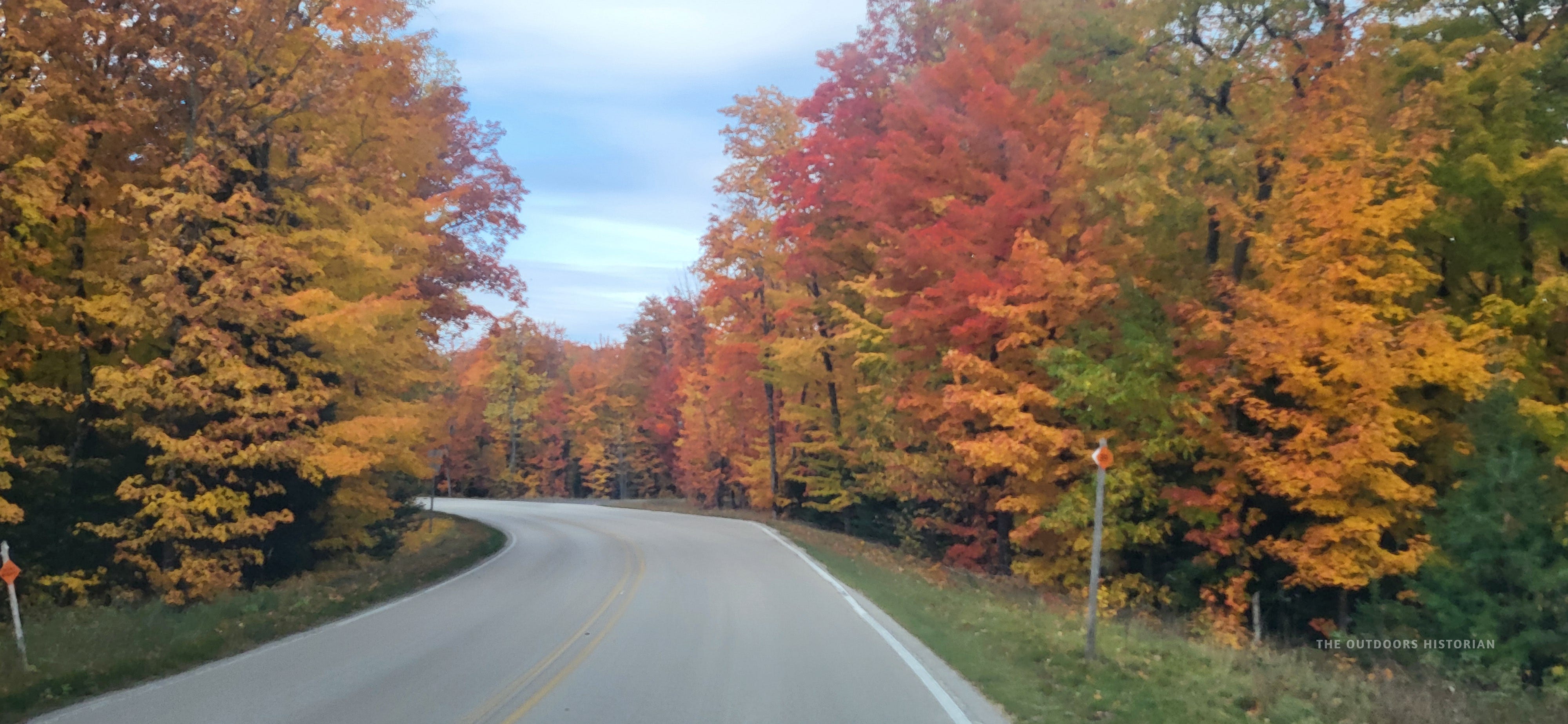
We spent our remaining time at the Log Slide wandering through some remaining old-growth trees, greeting them like old friends and soaking in their grounding presence. We lingered as long as we felt was reasonable. Then we left, driving west on H-58 through a tunnel of brilliant oranges and reds.

Reflections on the North and South Shores
Driving home, I reflected on the significant geologic differences between the South Shore and North Shore of Lake Superior. Much of the Minnesota and Ontario North Shore is defined by basalt and the granite Canadian Shield. These are ancient, hard, rocks that resist the water. The shore often feels permanent, rugged, and sharp.
Much of the South Shore, including most of the eastern and central UP and my current home in the Bayfield Peninsula, is defined by sandstone and sand. It is softer, shifting, and constantly being sculpted by the wind and waves. The geology creates a different emotional resonance.
Sue Leaf, author and South Shore resident, describes it like this:
The North Shore’s rock formations rising high above the water make the lake inaccessible in most places. The water is deep and cold immediately offshore. There are few opportunities to swim or boat. The lake is a backdrop for human endeavors on land.
On the South Shore, people interact with Lake Superior. They boat, sail, paddle, and kayak. The shallow water in the bays warms sufficiently for swimming and wading. Anglers ply the water in vessels bristling with rods baited with gaudy lures. When South Shore residents speak of the lake, they use personal terms. They say, “The lake is a misunderstood Beauty.” Or “The Lake is the Boss.” They refer to her as “she.” (Impermanence, pg. xiv).

I get what Sue Leaf is talking about when it comes to the South Shore. However, her analysis of the North Shore often feels centered on Minnesota, leaving the Ontario shore—the largest stretch of the circle—strangely absent. As a historian, this ‘inaccessible’ narrative strikes me as a ‘convenient forgetting.’ It erases the primary highway of the Anishinaabe world. For the Anishinaabe and the fur traders who followed the water routes (including some of my own ancestors), the North Shore wasn’t any more inaccessible than stretches of the South Shore like the Pictured Rocks Cliffs. Both shores required technical skill and navigational knowledge, and Anishinaabe peoples taught fur traders these skills when they arrived.

While the South Shore ‘invites connection’ through its sandy shallows, the North Shore illustrates connection through its deep-water history. If the South Shore is about accessibility to the lake, the North Shore demands a witness to its scale. You cannot look at the 85 miles of protected water in the National Marine Conservation Area and see a ‘backdrop.’ From the paddlers in Nipigon to the families splashing at Katherine Cove or Pancake Bay, the love for the Big Lake is not a South Shore monopoly. It is a shared, intimate reality that spans the entire circle.

The Lake is big. The Lake is vast. The Lake is varied. Whether it is in Wisconsin, the UP, Minnesota, or Ontario, people speak about the Lake in personal terms. She shapes all their lives. The vibe on the South Shore is different, but the love for Lake Superior is woven into the fabric of the entire watershed. I’m always reminded of this whenever I circle the Lake and connect with the people who call the watershed home.
My role as a historian is to bridge these gaps, revealing the ‘stacked maps’ that connect the shores. When you see these layers, you realize the entire lake is a deep archive of human connection. Diving into that archive is what leads to a greater responsibility of stewardship.
The Return
On a shoulder-season Circle Tour with remarkably little precipitation, we finished the drive home in the rain. As we crossed over the Montreal River back into Wisconsin and returned to our little corner of the lake, I realized something important. I had started this trip to begin to heal from the heartbreak of losing my job at Northland College. I was angry at the institution and fearful of the future. I spent 14 days looking to have fun with Eugene and reconnect with Lake Superior. I wanted to reclaim what I felt it had taken from me last May.
I didn’t find “closure.” That would be too simple. I still had anger and confusion about Northland and my own future. But I succeeded in one of my main goals: Eugene and I had a lot of fun, and we made a lot of amazing memories. That alone made the trip worth it.
And something more important shifted in me too. As we were standing on the Log Slide, and I explained the history of the lumber industry to Eugene, I realized that I was still teaching. I didn’t have a classroom. I didn’t have tenure. But I had the lake. And I had the stories. The transition from Associate Professor to Outdoors Historian isn't a retreat; it's an expansion of who I can reach and connect with the complex and diverse histories of Lake Superior.
I drove home realizing that I hadn’t just taken a vacation. I had done the first week of fieldwork for a job I am just beginning to invent. Right now it is not my 9-to-5 job, but it’s the job that speaks to my heart. And it’s a job I want to do for you—to help you find the ‘stacked maps’ of your own journeys.
Next Saturday: The Circle Tour Logistics Masterclass
Closing the circle at Pictured Rocks was the moment I realized that while my classroom has changed, my syllabus remains. But fieldwork—especially in the “Secret Season”—requires more than just historical curiosity; it requires the right tools because you can't read the deep map if you're freezing in your tent.
Next week, I’m pulling back the curtain on the mechanics of this more than 1,300 mile journey. I’ll be sharing my Circle Tour Logistics Masterclass, including:
The “Secret Season” Gear Report: We wanted a Sawzall and a hatchet, and why we made two different Canadian Tire “lighting runs.”
The Border Strategy: A guide to navigating customs with a truck full of gear (and what not to bring across).
The Historian’s Superlatives: My “Best of” list for the entire loop, from the most profound hidden history to the best campsite for reading the depths.
Our Favorite Meals: Our “go-to” favorites that kept us warm and fed on chilly October nights.
And to my paid subscribers: After the Logistics Masterclass, stay tuned for an exclusive ‘Director’s Cut,’ including raw footage from the trail and my full research reading list for this series. If you want to see these features, now is a great time to become a paid subscriber. It’s a direct way to support my deep-dive research into the hidden geographies of the Great Lakes. This includes a piece I’m working on now about the forgotten “Great Lakes Middle Passage,” content about my local region of the Chequamegon Bay, and more posts about my favorite spots along the Circle Tour and throughout the northern Great Lakes.
If you’ve followed this series, you know when I share about my favorite spots, I’m not sharing the same “fluff” that many travel sites recycle. When I pull over at a scenic overlook and take in the landscape and read a sign, I’m processing the ‘stacked maps’ of the site and understanding how they are part of a story of stewardship, industries, and survival. Your support allows me to keep ‘reading the depths’ and bringing these hidden stories to the surface.
If you’re ready to start mapping these nuances for yourself, make sure to tune in next week—and don’t forget to grab your copy of the Field Guide to start building your own syllabus.
It contains the itineraries, checklists, and planning tips I used to navigate these 1,300 miles multiple times. Most importantly, it includes “historian’s pivots”: the moments where a scenic view reveals a deeper story of industry or ecology. If you’ve found value in these stories, purchasing the Guide is the best way to support this ‘classroom with no walls’ and start planning your own journey through these layers of history.

Where is the one spot on the Lake Superior Circle Tour that feels like 'home' to you, even if you don't live there?
Thank you for giving me another promising destination to shoot for on Lake Superior's South Shore with the Grand Sable Dunes and the Log Slide! I've been to Pictured Rocks several times, but I always discounted heading to the dunes as I'm used to dunes from my stomping ground of Indiana Dunes National Park. But you've convinced me that the Grand Sable Dunes are something else altogether.
And I'm glad for you that they gave you an epiphany. It's wonderful when the land speaks to us like that.
I'm so grateful to everyone who has followed this series. Writing this final part was a journey in itself—realizing that the 'Log Slide' wasn't just a stop, but a metaphor for my new path. If you have any questions for me about this series or about me, I'd love to hear from you!