The Circle Tour Series Part 4: The Inky Dark and the Rock-Breaker
What Landscapes Remember When Systems Fall Apart at Pukaskwa National Park

Welcome to The Circle Tour Series. In Fall 2024, my partner, Eugene, and I circled Lake Superior. We left our home in Bayfield, Wisconsin, and headed clockwise up the Minnesota North Shore, crossing the border into Ontario. Then we drove along the Ontario shore before crossing the border at Sault Ste. Marie and traveling through the UP to return home. Most of our time was spent between Sleeping Giant Provincial Park and Pukaskwa National Park.
Part travelogue, part history, this series explores the intersection of industrial ruins, boreal ecology, and personal transition. It is a journey to see how landscapes survive when the systems built upon them—including mines, railroads, and careers in higher education—fall apart. This is Part 4 of 6. You can read Part 1 here, Part 2 here, and Part 3 here.
We left Neys with a sense of heaviness and excitement. The heaviness came not from sadness, but from the weight of the history we had absorbed—a burgeoning awareness of everything a landscape remembers, even after the systems built upon it fall away. Our excitement was tied to our next destination: Pukaskwa National Park, a place often called the “Wild Shore” of Lake Superior.
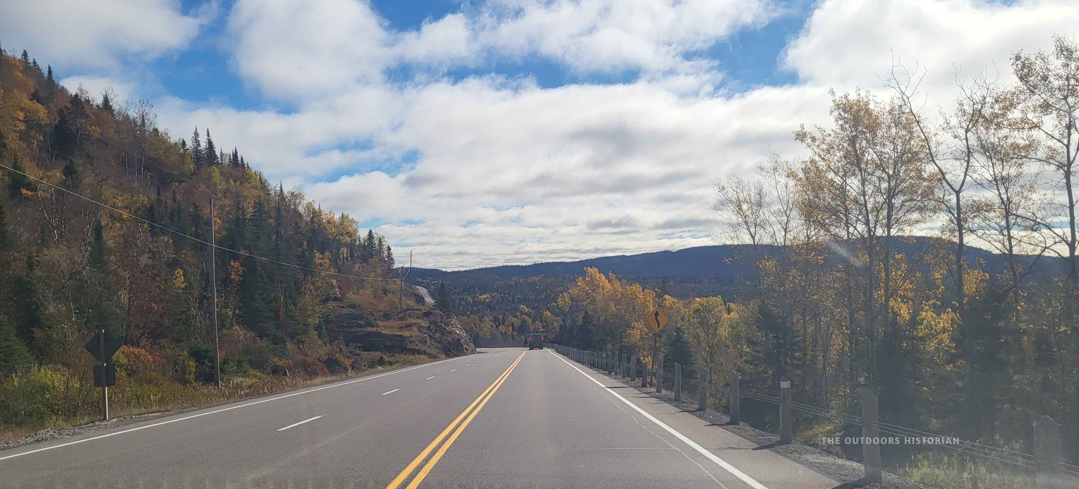
It is a romantic name. It suggests a place untouched and uninhabited. But as we drove south toward Marathon, we were reminded that “wild” is often just a synonym for “unindustrialized.” This shore has been a home for millennia.
We were reminded of that at our very first stop.
Lake of the Torches
Before entering the park, we stopped at the Gchi-Waaswaaganing Cultural Center, run by the Biigtigong Nishnaabeg Nation (Pic River First Nation). The view from here is commanding, looking out over a harbor that was once a prime fishery for the Anishinaabe.
The name Gchi-Waaswaaganing translates to “Place of the Big Lake of Torches.” It refers to the traditional practice of spearfishing by birch bark torchlight. For me, this sparked an immediate connection to home. In Northern Wisconsin, Lac du Flambeau is the French translation of the exact same concept—Waaswaaganing, or “Lake of Torches.”

It was a reminder that modern borders—like Wisconsin versus Ontario, or the US versus Canada—are recent overlays on a much older and interconnected Anishinaabe geography. It is also a reminder that this is a living geography; Anishinaabe people currently exercise their treaty rights to hunt, fish, and gather on both sides of this border.
Originally called Peninsula, the nearby town has another Wisconsin echo. It was renamed “Marathon” in the 1940s when the Marathon Corporation, a paper company founded in Wisconsin, built a massive mill on the harbor. The mill closed in 2009 and is now largely demolished. It is another chapter in the boom-and-bust story of the North.
But it also represents a deeper extractive history: Canadian boreal timber was harvested here to feed American markets back in Wisconsin. The wealth flowed south across the border, and when the macro-systems shifted, the ruins of the papermill were left behind. Standing there as a Canadian born-and-raised in Thunder Bay who now lives in Wisconsin, looking at the footprint of a Wisconsin company, the 'Refuge and Refuse' history of the lake felt like a closed loop. Like the lumber, I had flowed south. But I also kept my roots anchored in the north.
The sign outside the cultural center moved beyond that boom-bust paradigm to talk about the future. It reads: “The forest can provide food, shelters, medicines, green energies, and much more.” By listening and learning to Anishinaabe people who have stewarded this land for generations, we can move beyond the boom-bust cycles that developed after land cession treaties were signed in the mid-nineteenth century.
The Inky Dark
We drove across the bridge over the Pic River and arrived at the Pukaskwa gatehouse. It was a personal milestone because it was the first time either Eugene or I had visited this park.
To understand Pukaskwa, you have to understand its scale:
Pukaskwa National Park: 464,000 acres (mostly land).
Isle Royale National Park: 571,520 acres (but only 133,760 acres is land).
Pictured Rocks National Lakeshore: 73,235 acres.
By landmass, Pukaskwa is the largest national park in the Lake Superior watershed. It is an immense, roadless interior of granite and spruce. The campground at Hattie Cove is just a tiny pinprick on the edge of a vast wilderness.
Pukaskwa offers epic backpacking opportunities and phenomenal day hikes. My last post makes my loves of Neys clear, but if you want to spend a couple days doing day hikes on the Ontario North Shore, Pukaskwa should be your top pick.

We secured a campsite in the non-electric loop. Honestly, after the spacious, lake-facing sites at Neys, Pukaskwa felt a bit disappointing at first. The sites are small and enclosed by thick trees with no view of the water. But by setting the campground back from the shore, the park preserves the “Wild Shore” aesthetic completely.
And the campsites had a different beauty to share with us: the darkest nights I have ever experienced.
I have camped in the dark sky sanctuaries of the Boundary Waters and the Porkies. But Pukaskwa is different. It wasn’t just dark. It was an inky, velvety blackness. Standing beside the towering black spruce with the northern lights occasionally flickering overhead, the darkness felt physical. It wrapped around us in a way that was absolute. At Neys, we fell in love with the brilliance of the sky at sunset. But at Pukaskwa, it was the dark that hooked me.

The Pinnacle: Manitou Miikana
The next morning, we hiked the Manitou Miikana (Spirit Trail). This 2 km loop quickly became my favorite short hike on all of Lake Superior.
This trail epitomizes the boreal forest. I often talk about the Northwoods in Wisconsin and the UP, which are mixed hardwood and conifer forests. But Pukaskwa is true boreal. It is a world of black spruce, paper birch, Old Man’s Beard lichen draping the branches, and thick carpets of sphagnum moss.
The Manitou Miikana trail climbs to a series of overlooks where the granite plunges directly into the lake. Standing there and looking out at a horizon that swallowed the sky, I felt the “Land, Lake, Sky” theme of our trip reach its pinnacle.
I struggle with choosing “favorite” parts of the lake. There are places I’ve felt an instant connection with, like Old Woman Bay. There are places I’ve fallen more in love with as I learn their complexity, like the Keweenaw Peninsula.
Then there’s a very special category of places that simply take my breath away on first sight. This list includes Grand Portal Point at Pictured Rocks. It includes Ouimet Canyon. And it now includes the overlooks on the Manitou Miikana Trail.

I struggled to capture the moment on my cellphone. The bright, sunny October day was perfect for hiking, but terrible for photos. After several efforts, I abandoned the camera and just took it all in. I let the immensity of the views roll over me.
It was here that the last lingering stress of my job loss seemed to dissolve into the scale of the landscape. When you are standing on the edge of 464,000 acres of boreal forest next to the world’s largest lake, your own professional crisis feels properly small. It doesn’t disappear, but it finds its correct proportion.


Eventually, we stepped away from the overlooks. I felt like I could have stayed there endlessly, watching the interplay of light on the water, but we wanted to explore. We continued onto the Beach Trail to explore small rocky coves (which Eugene helped me climb down into) intermixed with a rare dune ecosystem.
Seeing dunes on this rock-bound coast triggered a memory from May 2019. I was exploring the other side of the Pic River with a friend, a fellow professor, and our students. The bridge to Pukaskwa was closed, but we unexpectedly ran into a citizen of the Biigtigong Nishnaabeg who offered to give us a tour of their powwow grounds and the dunes along the lake.
Our impromptu tour took place during a cold, windy, “freezing mix” mid-May day. Our guide was shocked to hear we were camping, noting that locals usually wait until after the Victoria Day long weekend to even attempt it. It was a spontaneous moment of connection, similar to meeting the man at Jackfish earlier on this trip. It reminded me again that this watershed is shaped by a web of relationships.

Complicating the Wilderness
Eventually, the beach trail took us back to the campground. After a late lunch, we headed to Hattie Cove to check out the canoe launch, where we found our first set of iconic red Parks Canada chairs.
I had originally hoped to visit Schreiber Beach and find the chairs I had sat in with my co-professor back in 2019, but our extended explorations at Jackfish meant we ran out of time. Sometimes, prioritizing off-the-beaten-track sites means you don’t get to everything on your list.
While at Hattie Cove, we also visited the Anishinaabe Camp. The camp plays an important role in complicating the idea of “wilderness.” This isn’t just nature. It is a political and cultural landscape.
From there, we hiked the beginning section of the Coastal Trail, walking through areas managed by controlled burns. This practice, rooted in Traditional Ecological Knowledge (TEK), was used historically in the Boundary Waters and Apostle Islands and is being reintroduced today. Seeing it applied here reinforced a central truth: this “wild” shore has always been a managed home.

Lows and Highs: The Rock-Breaker and the View from the Headlands
On our final morning, we hiked the Southern Headlands Trail. The weather decided to show us every mood Superior has. We saw fog, rain, wind, and sudden bursts of sun all in the span of two hours.
We spent hours on this short 2.2 km loop because we kept getting distracted. We found patches of saxifrage, an arctic plant that survives in these cold and exposed micro-climates. Saxifrage is an ‘arctic disjunct’—a botanical holdover from the retreating glaciers of the Ice Age that got left behind when the climate warmed.
The name literally translates to ‘rock-breaker.’ It survives the harsh winds of the Wild Shore by clinging to the microscopic cracks in the 2.7-billion-year-old granite. Seeing it thrive there, against all odds, felt profoundly symbolic. If this tiny plant can carve out a life in the unyielding rock long after its world shifted, it gave me hope for navigating my own shifting landscape
Following the coast of the rocky peninsula, we watched the waves crash against the granite, turning the water a churning white. Eventually, the trail climbs and turns away from the exposed lake toward Hattie Cove. We found our second set of red Parks Canada chairs, sat down, and just breathed the cold, clean air.
I reflected on the stunning boreal landscape we had hiked through. The old birch. The Old Man’s Beard. The cedar. The sphagnum moss. The shallow, acidic soils over ancient bedrock. The saxifrage.


The institution may have taken my job, but it didn’t take the gift my colleagues gave me: the ability to read the ancient Canadian Shield bedrock and recognize the resilient arctic saxifrage clinging to its cracks.
I realized I could appreciate the complexity of this landscape specifically because of my time at Northland College. I taught in the Superior Connections program, where I learned from other faculty and community experts. It was my own crash course in the geology and natural history of Lake Superior. In other words, it was my own liberal arts education.
All of a sudden, the complexity of my experience hit me. I could be rightly angry at the “powers that be” who mismanaged the college into financial exigency. But I could also be deeply grateful to my faculty colleagues for the knowledge they shared, and for the memories we made teaching together in this watershed.
I realized that while the institution had taken my job, it hadn’t taken my eyes. Or my training as a historian. The ability to read this landscape—to see the saxifrage and the sphagnum for what they truly are—was a gift from my colleagues that I get to keep forever.
I could hold the anger in one hand and the gratitude in the other. A friend and former colleague used to joke that the answer to any question about the human history of the watershed is always: “It’s complicated.”
As I travel around the lake in this new phase of my life, my relationship to the watershed has changed. It’s gotten more multilayered. More complicated. And that is not a bad thing at all.

Leaving the Woods
We barely scratched the surface on this first visit to Pukaskwa. We left the White River Suspension Bridge (a challenging day hike) and the park’s interior waterways for a future visit. But leaving unfinished business is just a promise to return. Learning how to prioritize your energy—knowing when to push for a challenging hike and when to just sit in a red Parks Canada chair—is the secret to surviving the Circle Tour. (It’s exactly why I included pacing strategies and curated itineraries in my Field Guide).
We headed back to camp for a final dinner of enchiladas and debated our next move. We had one night left before the drive home. We decided to take a risk: we would leave Pukaskwa the next day, drive the spectacular Lake Superior Provincial Park, and try to find a motel for our final night.

It was a gamble to try this on a Saturday night on a holiday weekend during leaf-peeping season. But after the spiritual recharge of Pukaskwa, we felt ready for hot showers and climate-controlled lodging again. And for the first time in awhile, I felt like luck was on our side.

In Part 5, we cross back into the United States, chasing the fall color through Lake Superior Provincial Park, and ending our journey back on the South Shore.
🧭 Stop Planning, Start Driving.
One of the hardest parts of the Lake Superior Circle Tour is knowing where to stop and where to keep driving.
In this post, I mentioned that we skipped Schreiber Beach to spend more time at Jackfish, and chose the Manitou Miikana trail over the White River Suspension Bridge. Those are the kinds of strategic decisions that make or break a road trip.
You shouldn’t have to guess which trails are worth your time, or worry about missing the significance of an iconic stop.
That is exactly why I wrote The Lake Superior Circle Tour: A Historian’s Field Guide.
This digital guide is designed to help you read the landscape and travel with confidence. It includes:
Google Maps Layers that visually illustrate the itinerary with the exact coordinates for the best overlooks, coffee shops, and breweries.
Custom Itineraries (8, 10, 14 and 21-days) that tell you exactly how to pace your driving.
The “Audio Syllabus” Playlist: A curated list of music and podcasts to match the history of the land you are driving through.
Need more hands-on help? If you are totally overwhelmed by the logistics, I also offer 1-Hour Strategy Sessions where we will jump on Zoom and build your perfect itinerary together.
Have you camped or hiked at Pukaskwa? What were your favorite parts? Let me know in the comments!
What a wonderful post. It’s interesting to see how you’ve discussed some of the themes that I’ve been discussing too but not here on substack. This was published last year..but I’m still thinking about these issues. "The "Boring Forest"? Canada's Boreal Forest is Actually a Breathing Mass of Life," Appalachia: Vol. 76: No. 2, Article 11.Available at: https://digitalcommons.dartmouth.edu/appalachia/vol76/iss2/11