The Circle Tour Series Part 3: The Ghosts of Jackfish and the Paradox of Prisoner’s Cove

Welcome to The Circle Tour Series. In Fall 2024, my partner, Eugene, and I circled Lake Superior. As I explained in Part 1, we left our home in Bayfield, Wisconsin, and headed clockwise up the Minnesota North Shore, crossing the border into Ontario. Then we drove along the Ontario shore, crossed the border at Sault Ste. Marie, and traveled through the UP to return home. Most of our time was spent between Sleeping Giant Provincial Park and Pukaskwa National Park. Part travelogue, part history, this series explores the intersection of industrial ruins, boreal ecology, and personal transition. It is a journey to see how landscapes survive when the systems built upon them—including mines, railroads, and careers in higher education—fall apart. This is Part 3 of 5.
In Part 2, our final night on the Sibley Peninsula was rocked by the strongest thunderstorm we’ve ever experienced in a tent. Leaving the Sleeping Giant, we headed east into the wind. We packed up in 70 km/h gusts, leaving a campground that many tenters had fled overnight.
The drive that followed—specifically the stretch from Nipigon to Marathon—challenges every assumption you might have about the “flat” interior of the continent. I will say it clearly: This is the most spectacular scenic drive on the entire Lake Superior Circle Tour. I know a lot of people favor a different section of the Ontario shore, but I stand by this choice. From Ouimet Canyon, to the Kama Cliffs, to the Rossport Islands, to the shores of Neys, it’s a breathtaking section of the Circle Tour. And since this section is home to the Casque Isles Hiking Trail and the Lake Superior Marine Conservation Area, we really just scratched the surface on what there is to explore by land or water.

The Cold Deep: Ouimet Canyon
Our first stop was Ouimet Canyon Provincial Park. This is a landscape where the earth seems to have simply pulled apart. The canyon is 150 meters (almost 500 feet) wide and drops 100 meters (over 300 feet) straight down into a floor that is home to a rare ecosystem.
The canyon exists because of a colossal diabase sill—the same 1.1-billion-year-old “sandwich filling” found on the mesas—that once capped this entire region. Over time, a massive vertical crack or fault developed in this thick volcanic layer.
Geologists suggest two theories for the canyon’s formation. One suggests that the sheer weight of glacial ice caused the 1.1 billion-year-old diabase sill to shift and slide. The second theory proposes that meltwater from retreating glaciers entered a massive crack in the diabase and tunneled through the softer rock beneath until the surface finally collapsed.
Because the canyon walls are made of such thick, insulating diabase, the floor of Ouimet Canyon stays perpetually chilled, never seeing the full heat of the summer sun. This “geological refrigerator” allows rare arctic-alpine plants to survive at the bottom, thousands of miles south of their usual home in the Arctic.
Standing at the overlook, you are essentially looking at a giant fracture in the Earth’s crust: the top of the cliffs represents the hard volcanic “cap” of the rift, while the shadows below hold a microclimate that has remained largely unchanged since the end of the last Ice Age.
The views brought back memories of leading my first student trip here in May 2019. We saw a moose where the canyon floor transitions to swamp, and the students spent the afternoon throwing May snowballs into the depths. It was a bittersweet memory. In 2019, I was introducing students to this land. Now, having lost my faculty position, I was standing here as a visitor.
At the same time, I was dazzled by the fall colors on the background of the stormy skies. And being a visitor came with its perks. It meant I was free, and able to explore how Eugene and I wanted to, without having to take into account the course learning outcomes, a preset schedule, or the needs of students.
Like the landscape, my feelings were layered, and sometimes fractured.

The Last of The Mesas
We stopped in Nipigon for the essentials: gas and a visit to Canada’s smallest Canadian Tire. Eugene needed a hatchet (having realized his Sawzall was great for creating chunks of wood, but we still needed something for splitting firewood), and I needed a spatula that I forgot.


After a stop at Love, Coffee, XO for Eugene’s last “real” lattes of the week, we crossed the Nipigon River Bridge. This bridge is a modern engineering marvel and the only link connecting Eastern and Western Canada. Yet it spans an ancestral Anishinaabe water highway that predates the bridge by millennia. The Nipigon River is the largest river on the Canadian side of the Lake Superior watershed and is often considered the headwaters of the Great Lakes. Near the river mouth are more flat-topped diabase-sill mesas and cuestas formed by the Midcontinent Rift. We camped near the rivermouth, overlooking this stunning landscape in 2019.


Properly equipped and fueled, we continued driving. We explored a two-track near the northernmost point of the lake, and we also explored the main lookouts along Highway 17. These provide stunning views of the landscape as you head toward one of the most dramatic diabase sills on the trip (along with Mount McKay and the Sleeping Giant), the Kama Cliffs. This is the section of drive I absolutely fell in love with. I’ve driven it before but never had the time to stop and linger at the lookouts. On this trip, it felt like stunning vista after stunning vista, with just enough sun in the unsettled skies to make the lake come alive with shades of blue and turquoise contrasted against the moody backdrop.

The Trapp Cabin and the Light Shows
We stopped at Rossport and looked at the chain of islands (like Wilson Island and St. Ignace Island) that were the final eastern outposts of the 1.1-billion-year-old volcanic sills that had defined the landscape since we crossed the border.
As we continued east, the “tableland” topography disappeared. Eventually we would reach the ancient, twisted granites of Pukaskwa National Park and Lake Superior Provincial Park, but first, we encountered the Coldwell Complex at Neys Provincial Park.

Neys is the eroded root of a massive volcano that was active 1.1 billion years ago. While it is geologically connected to the mesas of Thunder Bay, the landscape here feels sharper, starker, and more open to the full fetch of the lake.
When we arrived at Neys we checked into the Trapp Cabin. After the windstorm at Sleeping Giant, the solid walls felt like a luxury. But the real luxury was the sky.
That first night at Neys the “Land, Lake, and Sky” theme of our trip put on a “grand finale” mid-trip. We witnessed the most gorgeous sunset I have ever seen—surpassing even the sunsets facing due west that we’ve seen from the dunes of Lake Michigan or the shores of Drummond Island. The sky danced in an array of pinks, purples, and oranges. The wet sand reflected the colors and clouds like a mirror, dissolving the horizon line entirely. We took off our shoes and danced around in the wet sand, taking in the splendor of it all. Something lifted off of me in that moment.
As if that wasn’t enough, the night ended with a northern lights show that rivaled memories from my childhood. Standing on the beach, watching columns of red and green dance over the water, I felt a profound sense of both awe and peace. The isolation of Neys healed something in me. It felt magical. But as I would soon learn, this beauty masked a history of profound confinement.

The Ghosts of Jackfish
The next morning, we woke to sea smoke rolling off the lake. We took our time in the morning, drinking coffee with maple syrup and cream, and taking in the misty sunrise. Our mission for the day was to stop at Aguasabon Gorge.
The water was low at the gorge compared to my last visit in 2019 when the winter runoff has it at high flow, but it was still impressive to see the geology. The rock itself tells a story of the Midcontinent Rift. The gorge is carved through massive volcanic flows where the interaction between lava and water created a complex mix of structures. The high walls of the gorge provide a “side-view” of the volcanic layers, allowing you to see how different flows were stacked on top of each other and the interaction of the river with the 1.1-billion-year-old rock that has exposed internal volcanic textures that are otherwise hidden beneath the surface.
Next we were headed to find Jackfish, a ghost town I had failed to reach on a previous trip with students in 2019.
Jackfish was born at the turn of the 20th century to serve the Canadian Pacific Railway. It was a coal dock: a place where fuel was offloaded to power the steam engines that conquered the Canadian West. Train engines switching from steam to diesel contributed to Jackfish’s decline. Several fires and the ecological disaster of the sea lamprey, which decimated the commercial fishery, sealed the community’s fate.

The road in was narrow and steep, but Eugene’s Tundra handled it. We found ourselves standing amidst the skeletons of the town: old abandoned cabins and the rotting pilings of the coal docks.
At Jackfish, you are standing in a dramatic “transition zone” where you officially step off the relatively young, 1.1-billion-year-old volcanic rocks of the Midcontinent Rift and back onto the ancient foundation of the North American continent. These rocks are part of the Canadian Shield, dating back a staggering 2.7 billion years. Unlike the uniform, massive volcanic Coldwell Formation found at Neys, the granites and greenstones here bear the scars of immense heat and pressure from the earth’s early history, often showing a “stretched” or layered texture known as foliation.
Because of its unique position on the shoreline, Jackfish Bay acts as a natural geological trap, creating pocket beaches that serve as a “sampler” of the entire North Shore’s history. As you walk along the shore, you aren’t just seeing local stone; you are sifting through a billion-year timeline of the Great Lakes region, where 2.7-billion-year-old “basement” rocks mingle with vibrant red jasper, banded iron formations, and the occasional agate carried here by the relentless power of Lake Superior. You also find plenty of polished glass and ceramics—ephemeral reminders of the shore’s human history.
An Unexpected Connection
There is a strange continuity to the North. While exploring, we met a man maintaining one of the few active summer camps remaining in the cove. We got to talking, and it turned out he knew my father. Stranger still, I had met his father years ago when I spent summers at Whitefish with my mom, trail riding on the Pee Dee.
Even here, miles down a rough road in a ghost town, the networks of the region held tight. It was a reminder that “abandoned” places in the North are rarely truly empty, just like they were never truly wilderness. They have been defined by relationships for generations across millennia.
He was also a high school teacher, and we stood there bemoaning the state of education. Even though we were talking about public and private systems on different sides of the border, the similarities were surprising, depressing, and comforting all at once. Having this discussion on the stunning shoreline with the shells of abandoned cottages peeking out at us from the woods was a strange juxtaposition.

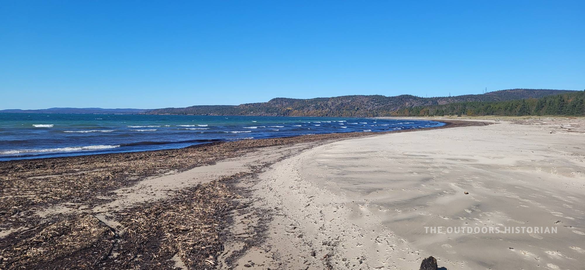
Jackfish is a beautiful cove, but it is a dangerous beauty. We spotted wire and rusted metal snaking through the sand—the “refuse” of the coal era making the water unsafe for swimming. It was a different kind of physical manifestation of the industrial scars we saw at Black Beach.
Similar to Silver Islet, Jackfish embodies the extraction cycle. It grew to serve the railroad and the fisheries, but the transition to diesel engines and the devastation of the sea lamprey killed the town’s reason for being. Walking past the rotting wood and wire on the beach, I felt a resonance with my own situation. Jackfish didn’t fail because its people stopped working hard; it failed because the macro-systems around it shifted. Diesel replaced coal. Lampreys invaded the lake. The economy moved on, leaving the infrastructure behind. Standing in that quiet ghost town, the “boom-and-bust” of the North felt intensely personal.

Prisoner’s Cove: The Architecture of Confinement
We only planned to spend two nights at Neys, but we loved it so much we moved out of the cabin and into a campsite for an additional night. On our final day, we hiked the trail to The Point, passing through the area known as Prisoner’s Cove.
It is a jarring name for such a serene beach. During World War II, this park was Camp 100, an internment camp that held German POWs. In Canada, POWs were divided into categories: “greys,” who were largely ordinary citizens, and “blacks,” who were dedicated Nazis that were potentially violent and a higher escape risk. Neys was one of nine “Black Camps” in Canada, designated for Nazis considered high-risk for violence or escape. It was surrounded by three barbed wire fences 10 feet high, with a guard tower at each corner.
But the architecture of confinement here was repurposed. While Neys held German soldiers (and occasionally anti-Nazis), the region’s camps and road crews also held another group: Japanese Canadian internees.
The War Measures Act stripped Japanese Canadians of their civil rights, granting the government unlimited powers that could not be challenged in court. It labeled them as ‘enemy aliens’ and required them to carry ID cards until 1949. Canadian federal law mandated a ‘defense zone’ of 160 kilometers along the British Columbia coast, imagined as a buffer against covert communication with enemy submarines. As a result, many Japanese families were evicted and sent to camps that previously held POWs or assigned to road crews tasked with expanding highways.
In 1947, the province of Ontario bought the property, and in 1965, Neys Provincial Park was created. Walking the beach, the irony was heavy. I was here voluntarily, seeking refuge from the heartbreak of losing my job. I was free to walk the beach, cook enchiladas de pollo verdes over a fire, and marvel at the northern lights. Yet, less than a century ago, this same beach was a site of confinement for men who were forced to harvest the timber of the Coldwell Complex. Some of those men committed heinous acts of violence overseas. Others were imprisoned for their ethnic background, which unfairly marked them as the enemy.
On our final day, Eugene and I hiked The Point Trail and found the rotting hulls of the Pigeon River Timber Company boats. These vessels hauled workers (including POWs from Neys and the nearby Angler camp) up the Pic and Little Pic Rivers to logging camps.
Logging was dangerous work. Driving logs had its own set of risks. The weather can change quickly. Waves and wind can push boats off course. Rocky shoals beneath the surfacea were a constant threat to the boats. A boat without an engine was at particular risk—steering would be impossible in bad weather if it got separated from the tug.

Standing beside the boats on billion-year-old rock, watching the waves crash, I felt small. The lake felt immense, but the weight of the history felt even heavier. I thought about the networks represented here: German soldiers captured across the Atlantic, Japanese Canadians displaced from the Pacific coast, all converging on Anishinaabe land on this rocky point on the very North Shore of Lake Superior.
We continued east, hiking part of the Under the Volcano trail where you walk right over Magmatic Breccia—what I like to call ‘frozen violence.’ You can see sharp, shattered square blocks of ancient rock that were blown apart and trapped mid-melt in a matrix of bubbling magma. It is a stunning, tactile reminder of the sheer explosive force that created the Lake Superior basin.

On our hike back, we noticed wood chips washing up on the beach. We debated: were these fresh driftwood, chewed up by the violent lake? Or were they the century-old refuse of the logging operations, still cycling in the surf? At Neys, the line between natural and industrial is never quite clear.
Hook, Line, and Sinker
In the late afternoon sun, we took a drive to the mouth of the Little Pic River. We saw metal hooks still sunk into the rocks of the Coldwell Complex. These were the anchors where rafts of logs were held before being towed to sawmills. Today, this area is a popular launch for canoeists.
As we watched, a train roared down the CPR tracks overhead, a modern echo of the industry that shaped this place. Once again, I was struck by the contrasts. Recreation and industry. Past and present. These layers aren’t always visible if you don’t know what you’re looking for. That’s exactly the gap my new e-book The Lake Superior Circle Tour: A Historian’s Field Guide is designed to fill: it teaches you how to “read the landscape” at some of the most popular spots on the Circle Tour and shows you how to connect these sites into a logical itinerary that creates a meaningful trip.

On our drive back to our campsite, we saw a family of three well-fed bears. They were a reminder that while the prisoners and the guards are gone, the land has its own inhabitants whose ancestors have lived in the watershed for generations.
Neys is an important chapter in the story of many layers of Lake Superior history. For me, this complexity didn’t ruin the trip; it reignited my passion for the watershed. The “job loss” grief I had been carrying felt different here. The scenery was stunning, but the history was engaging. As a historian, I am drawn to the messy, uncomfortable stories: the treaty histories, the failed mines, the internment camps.
Neys hooked me. It is a place where the beauty draws you in, but the history makes you stay. It was the kind of place that reminded me of why I spent the time I did training to become a historian; the kind of place that reminds me why it matters to tell the stories of the intersections of human and land. And for the first time, I realized that I didn't need a classroom to tell these stories. The landscape itself is the syllabus, and maybe it matters more to teach it right here, out in the open.

In Part 4, we head to our final camping destination: Pukaskwa National Park, where the road ends and the “Wild Shore” begins.
Want to experience the Ontario North Shore like this?
As I mentioned, the best parts of the Lake Superior Circle Tour are often hidden in plain sight—like the history at Neys Provincial Park.
That is exactly why I wrote The Lake Superior Circle Tour: A Historian’s Field Guide.
Officially launching today, this 200+ page digital guide gives you my exact 8, 10, 14, and 21-day itineraries. It is packed with the deep history, “Reading the Landscape” geology lessons, and curated stops you need to stop guessing and start exploring. Grab your copy here!
Need more help?
The Expert Route: Overwhelmed by the logistics? Book a 1-Hour Strategy Session to troubleshoot your itinerary with me.
The DIY Route: Grab my Free Starter Guide.
Questions about your own Circle Tour or route? Let me know in the comments!