The Blowdown of 1999
A Remembrance of Places Past and A Very Local Forest History

The Build-Up
On July 4, 1999, my mom and I experienced the most extreme weather event in northwestern Ontario’s recent history. A quarter of a century later and I’m still reflecting on how that event shaped my relationship to place.
That day my mom and I were at our family’s camp (the northwestern Ontario term for cabin or cottage). It was just us—well, us plus our two horses and our family’s two Labrador Retrievers. I was a preteen. My older brother was in high school. He and my dad were traveling with his hockey team.
Our camp was on Whitefish Lake, southwest of Thunder Bay. As the crow flies, the property is only a couple of miles north of the Ontario-Minnesota border. On the American side, the Boundary Waters Canoe Area Wilderness and Superior National Forest stretch south and west. When I was a kid, we lived in the city most of the year and boarded our two horses. But in the summer, for two glorious months, my mom and I lived with the horses at Whitefish and went trail riding on old two-tracks that used to be logging roads and old railroad beds that connected turn of the century mines and lumber camps with ports on Lake Superior.
These summers were both idyllic and a reality check. The reality was the bugs were bad. Mosquitoes. Black flies. Stable flies. Deer flies. Horse flies. Multiple hatches. And if you think they are bad around humans, they are even worse when animals are in the mix. And our two horses didn’t get along when they were turned out together. And their paddocks were small with limited grass growing in the thin layer of soil over the Canadian Shield. We spent a lot of time rotating the horses between their shady stalls where box fans kept them cool and their limited, separated outside paddocks with meager grass. All of this so we could ride the old two-tracks through the forests on Crown Land. If you had the endurance, could brave the hordes of bugs, and handle the rugged terrain, the options to explore seemed limitless.
A map of Whitefish Lake and the two-track we used to ride on. Map created by Emily Macgillivray.
It was a particularly hot day. It was also extra humid and muggy. The air felt thick. Wet. Heavy. Like you were wading while you were walking. By mid-morning, the bugs were bad, and we brought the horses into the barn so they could stand in their stalls in front of their fans. Even with the assistance of their fans, they were hot. The dogs were hot. We were hot. It was in the 80s already and it wasn’t even noon. We didn’t have air conditioning. It was pretty unheard of for camps to have air conditioning in those days, no matter how well-equipped they were otherwise.
Days like this were too hot to do much of anything. It was the kind of day where if storms held off, you’d probably go swimming. What else could you do to cool down? The problem was our camp was on a shore of Whitefish that was lined with thick wild rice beds. The lake bottom was covered by several feet of muck and, as my dad said, “loon shit.” It made for great duck hunting but bad swimming. We had to drive to nearby lakes for swimming. Or we played in sprinklers and with Slip’n’Slides.
My mom and I settled down in front of a puzzle, our own box fan circulating the hot air. We had lunch. Then, the sky started to get dark. It seemed like storms were rolling in, which is common in the summer. My mom and I walked up to the barn and closed the sliding doors to keep out any blowing rain. We checked the horses' water buckets and gave them another flake of hay. We turned off the fans in case the storm had intense lightning. All part of our usual routine.
As we walked back to the camp, somehow, it felt like the air got even thicker and heavier. The sky turned into a strange color. Storms usually made the sky dark, but this time, an eerie green tint washed over everything. It seemed like an ominous sign. Thunder rumbled in the distance. We could tell it was headed in our direction. We settled into the camp’s sunroom. It had glass patio doors and expansive views of the south shore of the lake, including the striking cliffs that stood guard over several lakes in the region, including Arrow and Rose. It was our favorite spot to watch thunderstorms.
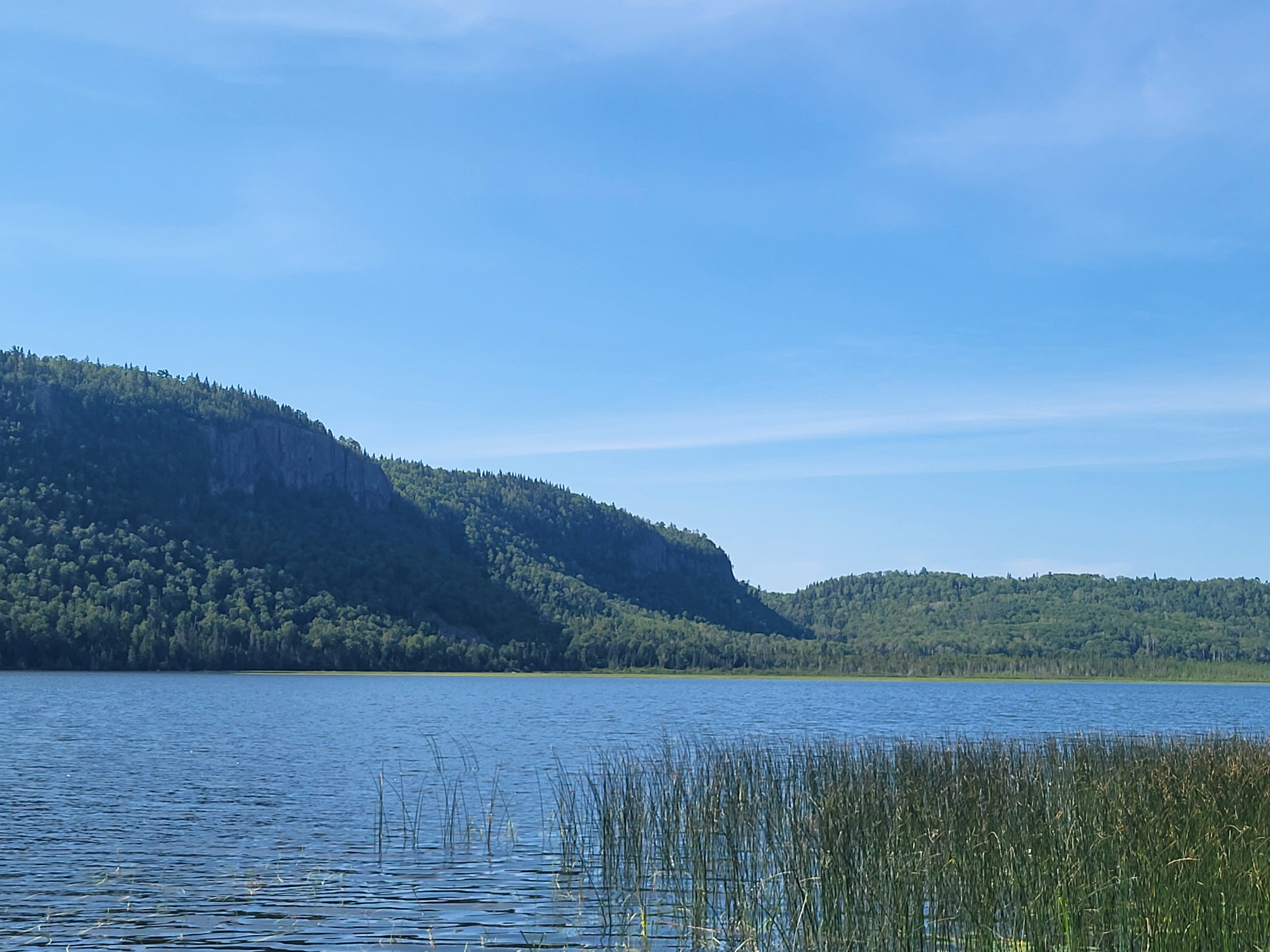
The south shore cliffs of Whitefish Lake. Photograph by Emily Macgillivray.
The Blowdown
As the thunder got closer, the sky turned a strange blue and purple color. Then, thunder clapped. The wind increased. Forks of lightning crackled over the horizon. The lake kicked up, creating chop and white caps. Suddenly, the sky opened up, and rain poured down. The wind got stronger. Fierce. Over the top of white caps, it sent cascading gusts across the murky, churning waters. Closer to shore, the wind bent the stalks of wild rice to the water. The thunder got louder. Lightning crackled at an increasing frequency. The rain drove hard down, pounding against our roof. Outside, we could see the rain running across the ground. Sheets and rivulets of water streaming over the ground, pouring toward the lake.
Our patio chairs blew off the deck. Particularly strong gusts of wind picked up an aluminum canoe and boat my dad had stacked along the shoreline and tossed them to the side. They landed on the ground in front of the sunroom. If the wind had moved them south rather than west, they may have been tossed into the lake. In that case, they may have joined someone’s aluminum boat that wrenched itself free from a dock and was blown across the lake toward the south shore. We tracked it with binoculars.
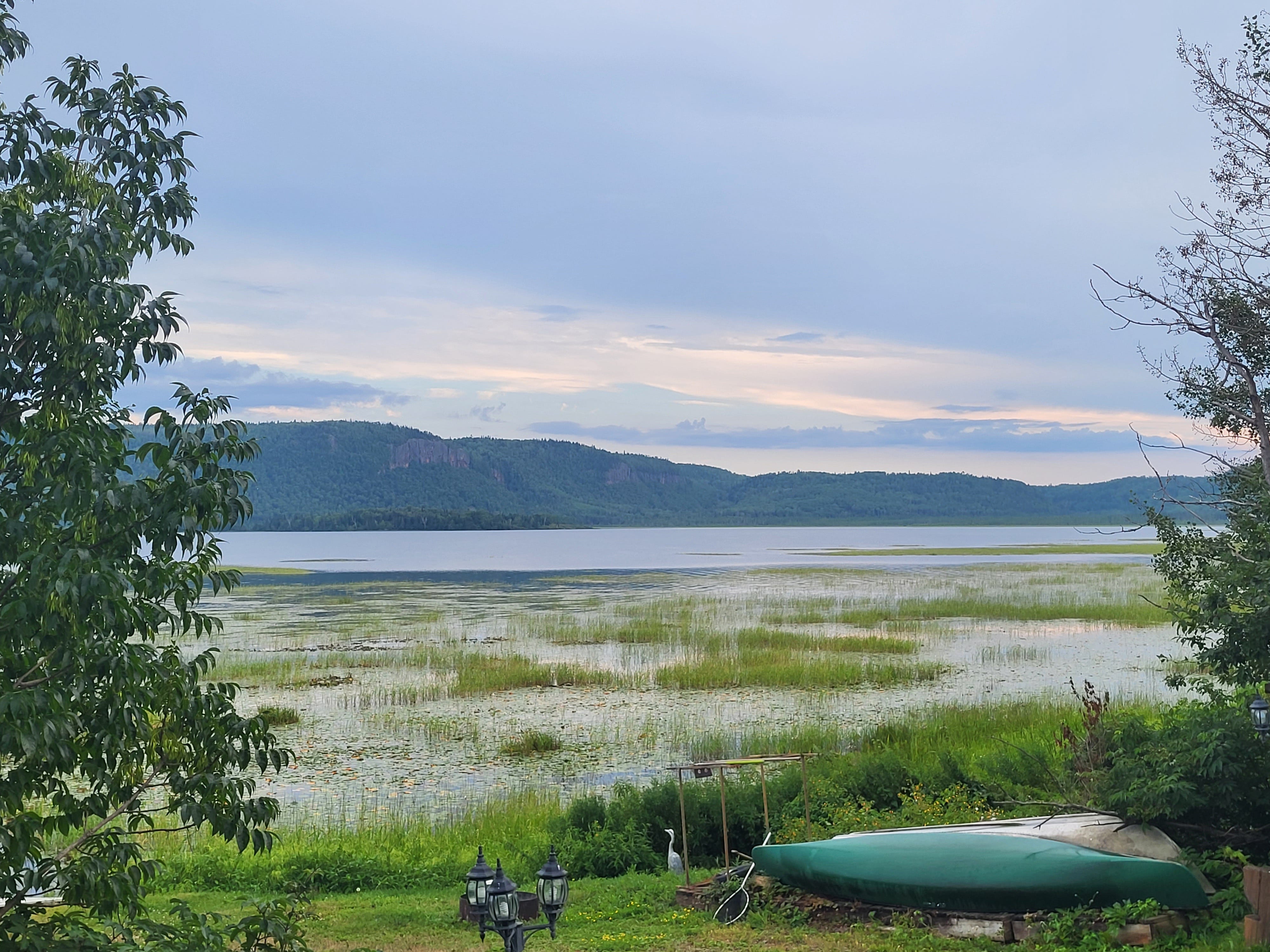
The view from the sunroom at our camp. Photograph by Emily Macgillivray.
We heard loud cracks—not just booms of thunder but trees coming down. We didn’t see any in our direct line of sight, but the smaller trees in our line of sight were bending sideways, leaning in the wind at angles we’d never seen. We knew at least some trees had landed on the power lines because, by 2:40 p.m., we lost power. We tore ourselves away from watching the storm and pulled out flashlights and candles. Power outages weren’t uncommon in the summer, so they were always accessible. We lit some candles and turned on some of the lantern-style flashlights. Unless you were directly in front of a window, it was dark. I don’t think I had ever seen it so dark in the afternoon. We returned to the sunroom.
A bird whipped by in front of the window. It wasn’t flying—the wind had grabbed it and hurtled it. Other accounts of the storm mention birds as large as blue herons struggling to fly. Branches and leaves were flung off trees, carried by the wind. I felt like I was in Dorothy’s house in The Wizard of Oz. Was this what a tornado was like? I hadn’t seen a funnel cloud, so maybe it wasn’t a tornado. But whatever it was, it was something I had never seen before. Something my mom had never seen before.
In hindsight, maybe we should have moved away from the sunroom with its glass patio doors and windows. Unlike Dorothy, we didn’t have a storm cellar to run to. I guess we could have gone into the bathroom. At the time, it was tiny, with a toilet and a standing sink. Instead, we sat mesmerized by the storm until, finally, the wind died down, and the thunder and lightning subsided. The rain lessened. We began to survey the damage.
The Immediate Impacts
The power was out. The phone lines were down. This meant the internet was down since it was the dial-up days. We had no cell phone with us (my dad and brother had the “family cellphone”). Communication was cut off. This type of disconnection is hard to imagine in 2025. We had no way to send a text or an email. No way to make a phone call. No way to receive a phone call. We couldn’t call Environment Canada for a weather update, although we did have radios we could listen to. We couldn’t call Ontario Hydro for an update on the power. We couldn’t call my dad. He couldn’t call us.
We walked out our door, looking at the back of the camp, and then up toward the barn. Most noticeable was a large poplar (or popple or aspen, depending on the region you live) that snapped in half. Its top half fell directly on the barn. Structurally, the barn seemed fine from our perspective. We trudged toward it and hoped for the best.
Upon arrival, the barn seemed in decent shape. It was less than five years old and was built to withstand the heavy snow loads in the winter. Inside, my horse stood in her stall. She was pressed against one wall, fine but looking unamused as water dripped from the ceiling in the other half of her stall. One of the poplar branches punctured the roof. But otherwise, everything was undamaged. She might be unimpressed by the leak, but she could survive till it got fixed. The only danger she was in was possibly getting a little wet. Things could have been much worse.
The rain continued to lighten up. We went back outside and looked up and down the powerline, seeing multiple trees and branches leaning on it. We knew if things looked this bad so close to us, it would probably be a few days before we got power back. When we looked south across the lake, we could see holes in the distant tree line along the top of the cliffs. Large sections of trees must have come down to cause such drastic changes.
We started up our road. We were one of the final properties at the end of a long, shared driveway. As we got behind the barn, we noticed a tree had fallen on a section of the fence. As we walked, we began noticing more downed trees. Many were blocking the driveway. Along with our communication being cut off, we were also blocked in. Neither my mom nor I knew how to use the chainsaw in the garage. That was my dad’s role. In some areas, masses of downed trees fell in a tangled mess beside the driveway. We’d never seen any storm damage like this.
Luckily, it didn’t take long for us to run into our nearest neighbors. They were proficient in using chainsaws and worked on clearing the trees. My mom and I helped break off branches of the trees and clear them. We also restrung the hotwire along the fence. Hours later, we finished. Then it started to pour again. Luckily, though, this rain did not come with catastrophic winds.
Our main obstacle without having power was not having running water. But we did have access to overflow from our artesian well in the creek on our property. We could get drinking water for ourselves, the horses, and the dogs from there. We could cook on the barbecue. We certainly didn’t need heat. And we had plenty of flashlights with batteries. We couldn’t communicate, but we would be fine for the evening.
It turned out that more help was on the way. A friend of my parents, the carpenter who built the camp and the barn, knew my mom and I were by ourselves and came to check on us with his teenage son. He came down the recently cleared driveway. They quickly went to work clearing the poplar from the barn and patching the roof.
We all marveled at the strength of the storm. “People at Mosquito Raceway saw funnel clouds,” the carpenter reported. “It was a twister.” He said it went from Whitefish through the Nolalu area to South Gilles and into Slate River. Already, accounts were spreading. Maybe we were in a tornado, I wondered. Other than turning on the radio, we had no way to access information. We were left with our own awe and wonder.
The next day, my mom and I cleaned out our freezer as best we could, storing the food in coolers and driving to town. Along the way, we saw many more downed trees. It seemed like signs of the storm were everywhere. We transferred the food to our fridge at home. The city had power; the outlying areas didn’t. But even with listening to the news on TV and grabbing the newspaper, we were left with little information. The local media had limited resources and few answers. The only real consensus was the storm was big—a blowdown, people were calling it. Thunder Bay was hundreds of miles away from the main provincial and national media based in Toronto and Ottawa. They had resources, but no interest.
Now we know the blowdown was a derecho, a line of powerful thunderstorms. Combined, they had the power of a Category 3 or 4 hurricane. Straight-line winds approached 100 miles an hour. South and west of us in the Boundary Waters Canoe Area Wilderness between 3,000 and 4,000 canoeists were camping. An estimated 48 million trees were toppled in the storm damaging campsites and blocking portages.
The blowdown was my first experience with a landscape I knew well, undergoing a massive, sudden, and dramatic transformation. My mom and I had experienced and survived the most major weather event in our region’s recent history.
I wondered if this was a sign of what was to come after the turn of the millennium? I vaguely knew about something called global warming (now known as climate change) and everyone knew the concerns about Y2K. But my worries weren’t grounded in scientific evidence about the severe weather. That would have been more realistic. Instead, it was the angst of a preteen, already riddled with anxieties about life. And I hadn’t yet really processed the loss that I would eventually come to feel from the storm. That would take a long time for me to truly feel and even longer to name.
The day after the blowdown, the power came back at Whitefish. Then, it cut in and out and again for several days. In a few days the phone line was restored. We could once again make phone calls and load webpages at a painstaking pace.
My dad and brother returned from their trip. They were thrilled with how many my brother performed, but in the end, nothing came of it. His hockey career ended when he graduated high school. Life is funny. You never know which one of you is going to experience a life-changing event. It might not be the one you expect. And sometimes, you think and maybe even hope certain things might change your life, but it turns out, they are just a blip in your overall path.
The blowdown on July 4, 1999, permanently changed the land. In some areas, old-growth pine and cedar that had stood for hundreds of years were violently thrown to the ground in the storm. But it didn’t just change the forest. The storm also permanently changed me. Even if I didn’t know it at the time.
Echoes of History
After the storm, most of the two-tracks where we rode were now covered with swathes of downed trees as far as the eye could see. The trees looked like pick-up sticks—a mess of trunks and branches strewn in every direction, overlapping and interlocking to create a seemingly impenetrable labyrinth in places.
My dad and some of our neighbors, who used the two-tracks to access hunting and fishing spots, began the long, slow, arduous work of clearing a path with chainsaws. Eventually, the area they cleared connected with an area where a logging company acquired rights to come in and harvest the downed trees and cut sections of the remaining forest. This happened on Crown Land across the region.
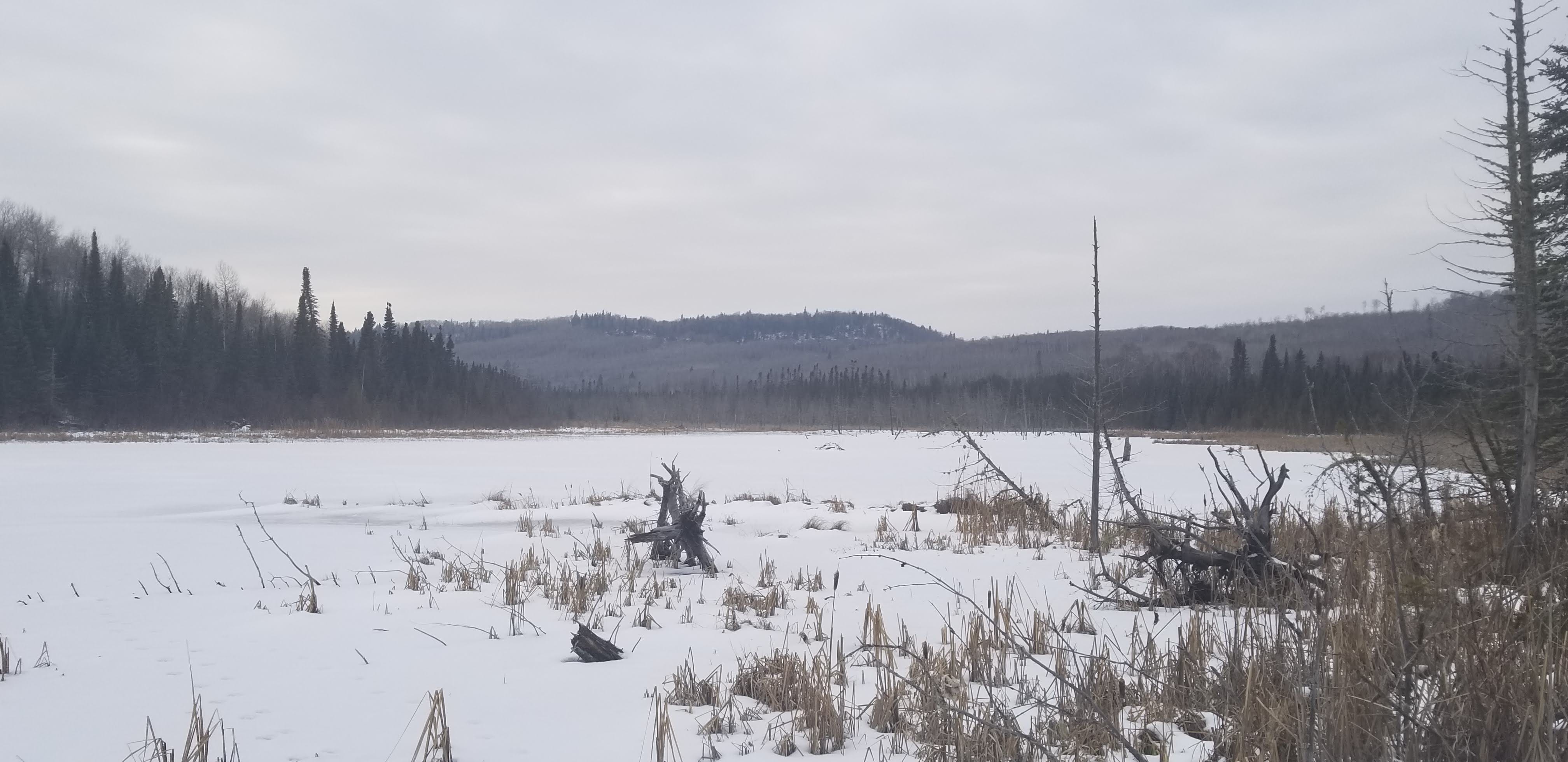
A frozen beaver dam, with Sun Hill in the background, along the section of the two-track cleared by my dad and our neighbor. Photograph by Emily Macgillivray.
The land had been logged before, at the turn of the twentieth century, by settlers—some who arrived in the fur trade era and others who were more recent immigrants. The two-tracks we rode were a remnant of these earlier generations of logging.
The year after the blowdown was the start of a new millennium. This pivotal date in the calendar corresponded with a drastic change in the landscape: we didn’t just ride on the remnants of old logging roads like we had in previous years. Instead, we a rode across a barren landscape not unlike what it would have looked like after it was cutover for the first at the turn of the twentieth century. A land stripped of trees almost as far as the eye could see.
In the mid-nineteenth century, the United States and British Canada signed land cession treaties with Anishinaabe, Menominee, and other Indigenous peoples in the northern Great Lakes. Then, logging companies moved in to ceded territory and began clearcutting the land that Indigenous peoples stewarded for generations. Initially, loggers used rivers to transport conifers like white pine and cedar. As railroads developed, hardwoods were also cut (unlike pine and cedar, they didn’t float in water).
In the late 1800s and early 1900s, fires broke out, fueled by massive piles of slash (or waste lumber) and sawdust. The Peshtigo Fire of 1871. The Ontonagon Fire of 1896. The Matheson Fire of 1916. The Cloquet Fire of 1918. And many many more. In some areas like the Kingston Plains in the Upper Peninsula of Michigan, fires burned so hot that they damaged the topsoil. Today, there's minimal regrowth, and you can still see charred stumps that tower as high as adult humans. In that area, they are the only remaining remnants of the old growth that was logged.
Before the blowdown, our most common route had a section where the trail forked. If you went left, heading west, you stayed at a higher elevation and eventually arrived at a slough. The forest was thick with poplar and dense with undergrowth. It was almost always buggy with very little wind.
If you went right, you headed north, down a bedrock slope toward the Whitefish River. At the bottom, it felt like entering a different world. It was a short but distinct section of older forest. There was red and white pine mixed in with the spruce, balsam fir, poplar, and birch. The canopy created shade, and there was less dense understory. The ground seemed softer—cushioned by generations of pine needles falling and decomposing—and held together by the exposed roots of the pines. The roots tended to extend horizontally, their depth limited by the soil saturation and the bedrock underneath. The lower elevation and nearby river kept the soil wet for a large part of the summer. Ferns, other wetland friendly plants, and moss carpeted the forest floor. It was one of my favorite sections to ride.
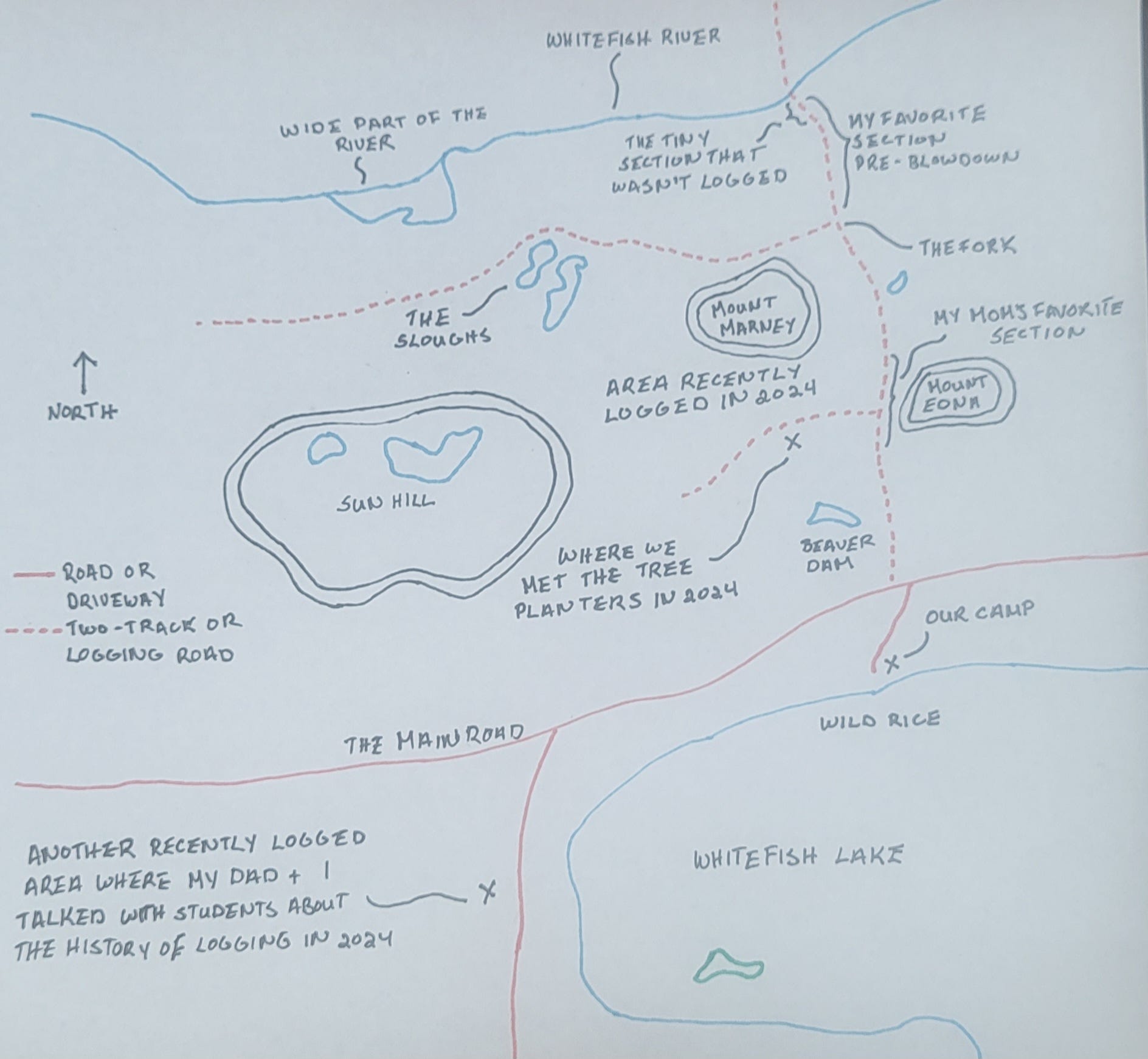
A map of the main two-tracks we used to trail ride on. Map created by Emily Macgillivray.
When we rode to this section of trail a year after the blowdown, the forest I loved was gone. Changed forever. The two-track was widened into an active logging road. The canopy was gone. The trees were gone. The pine needles were gone. The roots were gone. The ferns and the moss was gone. The land was open and exposed. Barren. On the plus side, the logging roads created new paths and expanded the areas where we could ride. But the forest I once loved was permanently changed.
Nature writer Brian Doyle describes how trees are built by the downward hunger for earth and water and by their upward yearning for light. Maybe that is why humans are drawn to forests. Maybe we have a similar hunger and yearning. Maybe for us to endure in a world filled with anxieties, we need to spend more time among the trees, learning to understand the changes of a forest. Over the past twenty-five years, searching for old-growth forests in the northern Great Lakes has become one of my past times. It has healed me during some of the most challenging times of my life.
Over a quarter of a century after the blowdown, there’s been plenty of new growth in the areas that were logged. Some of these stages of secession have their own gifts, including a few years where exposure to sun and the right weather conditions created amazing blueberry crops. Some birds, like the bay-breasted warbler, disappeared, and blackburnian warblers, struggled, but others thrived. In Quetico Provincial Park west of our camp, and the Boundary Waters to the south and southwest, staff and volunteers cleared campsites, trails, and portages, but there was no logging. In these areas, birds like magnolia warblers, white-throated sparrows, chickadees, and woodpeckers (who likely had plenty to eat with the broken, downed, and dead trees), thrived. The rarely-seen yellow-bellied flycatcher appeared after the storm and in the following years. The upturned tree roots created a plethora of ideal nesting sites for the bird.
While the blowdown created opportunities for some species of flora and fauna, throughout the first twenty-five years of secession, the older forest along the two-track on the way to the Whitefish River has not returned. You can’t rush the growth of a forest. It takes time. No matter what the forest management is.
This is not a simple story. I guess it never is when it comes to land and how it changes.
The Present
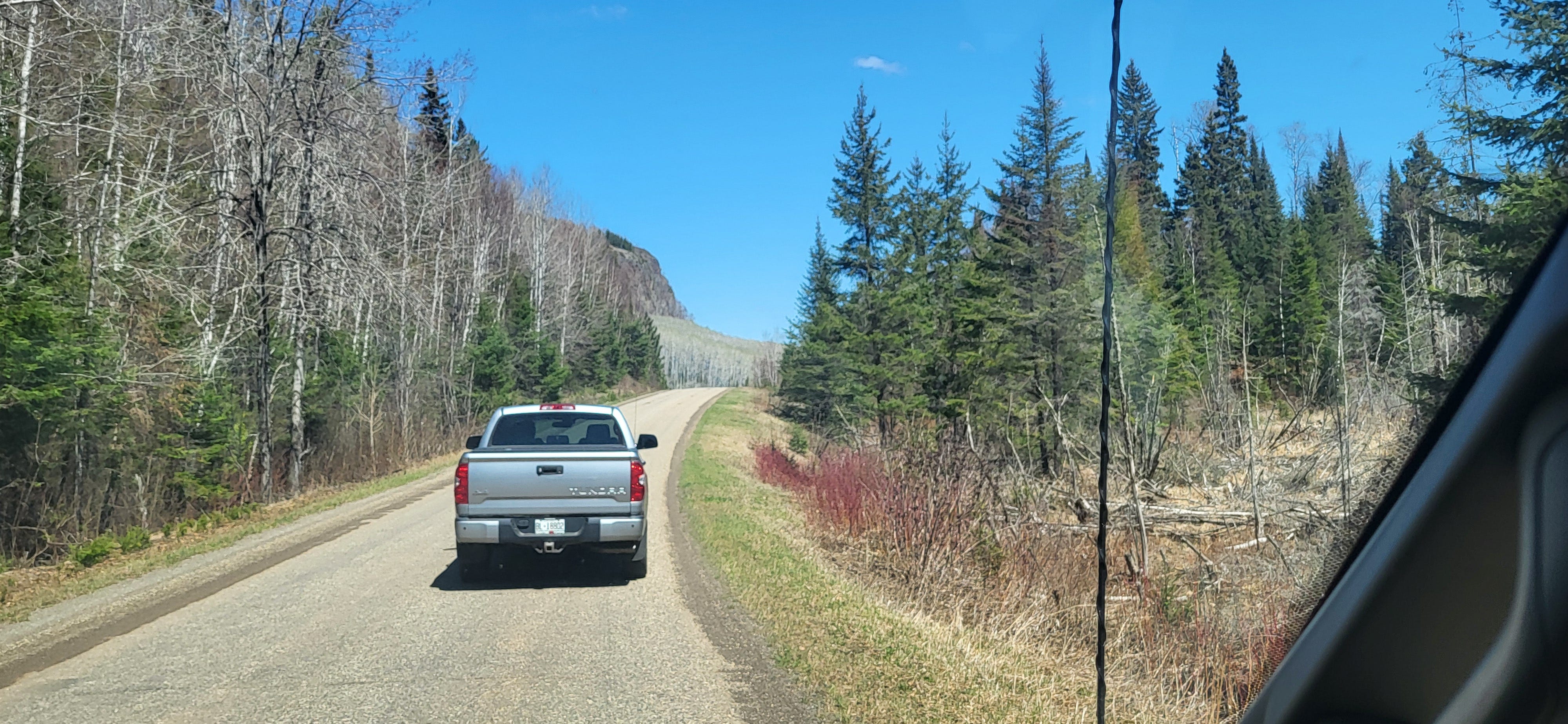
In May 2024, I headed up the old two-track with my dad and a group of first-year college students from Northland College in northwestern Wisconsin. They were in a program that focuses on learning about the Lake Superior watershed through interdisciplinary perspectives and experiential learning. We drove part-way, stopping long before it forked. We began walking along the trail to see an area that had recently been logged.
It used to be one of my mom’s favorite sections: the two-track wound its way along a low bluff between two high points (Mount Marney and Mount Edna) through a forest of mainly birch and poplar. It was a section my dad and our neighbor cleared following the blowdown.
About fifteen years later, in grad school, I learned archeologists had studied the area, finding evidence of human habitation going back centuries before Europeans arrived in the region. Now, it was cutover. Another section of land was transformed.
Soon, we came across tree planters along the side of the road. They were mainly university students looking to make some decent money in the summer. We chatted with a few of them. “It’s beautiful country,” one of them said, “if you can stand the bugs.” Another seemed skeptical of their job but motivated by the pragmatic aspect of making money through long, hard days of work. “We’re out here planting these GMO trees. Clones of each other.” She shrugged, seemingly unconvinced by their efforts. Gesturing toward the land, she remarked on their efforts, “I guess it’s better than nothing.” Beneath her words were concerns that we weren’t doing enough or the right things after logging.
As we left the tree planters, one of the college students inquired, “Are they doing a good job managing this forest?” I sighed, pausing and composing my racing thoughts for a few seconds. “It’s complicated,” I began.
I tried to explain that it depends on how you define good, and the different groups have different goals for forests. What one group of people values isn’t the same as what another group values. All this shapes what we view as “good.” And one group of people can value different things at different times. White pine was once central to the logging industry in this region. Not anymore.
I tried to avoid oversimplifications. I want to give the students tools so they can make assessments on their own. Not just in that moment, but in the future, when they are standing on different lands they have questions about. I emphasized that depending on their values and goals, they may or may not find the current efforts “good.” I pointed out some of the problems with monocultures.
Then I raise the larger question of whether we should be logging in ways that clear large sections of land. I emphasis that I know we need wood products. Yet there are alternatives, like the practice of selective logging. I explained how Menominee peoples in northeastern Wisconsin have stewarded their healthy old-growth forests since the mid- nineteenth century when they signed land cession treaties with the United States using selective logging, but not clearcutting. The timber industry continues to play a central role in their economy. They also have some of the healthiest old growth forests in the northern Great Lakes.
The students listened. We all reflected on changes to the land during our walk back to our van. I was tempted to stay and mourn for the lost landscapes, but I also didn’t want to hold up the group. No one else other than my dad was here before the first blowdown. No one else really understands the loss. They are not mourning. Alone with my feelings, we drove back to my parents’ camp.
Driving with college students to recently logged areas in 2024. Photograph by Emily Macgillivray.
Later in the day, we saw another clear cut at the west end of Whitefish Lake along the East Arrow Lake Road. Standing in a logged area with a view of Whitefish in the background, my dad explained the history of logging in the area in the nineteenth and early twentieth centuries. He described how old white pines were cut from this area, sent down the hill on a log slide, and floated through Whitefish Lake, to the Little Whitefish River, to the Arrow River, and to the Pigeon River, where they would finally enter Lake Superior. Some of these white pines were floated to Thunder Bay (at the time, Port Arthur and Fort William) where they were used as pilings for the docks built for the elevators that received shipments of grain from the Canadian Prairies delivered by trains. As ports, Port Arthur and Fort William connected the economy of western Canada with the Great Lakes and the Atlantic. Now, many grain elevators stand empty along the shore—reminders of a once-thriving industry in a city that’s had a declining population my whole life.
In 2024, the logging companies weren’t logging white pine. Instead, they were cutting regrowth of mainly poplar, planted in the wake of a previous cutover. White pine takes a long time to grow and reach maturity, so after the original cutover, it was never replanted in large numbers. Cutover and then cutover again. Layer upon layer, the landscape continued to be transformed, and corporations continued to extract from it.
I asked the students where else we saw evidence of this route the logs traveled. “At High Falls!” one exclaimed, remembering that we saw remnants of the flume that the logs shot over along the side of the large waterfall on the Ontario shore of the Pigeon River.
There are echoes of this history of the forests scattered over the changing landscape. Sometimes, signs created by state parks, provincial parks, and other government bodies and non-profit organizations point out these fragments. If you pay attention, learn, and listen, you can start weaving the pieces together to see the larger whole.
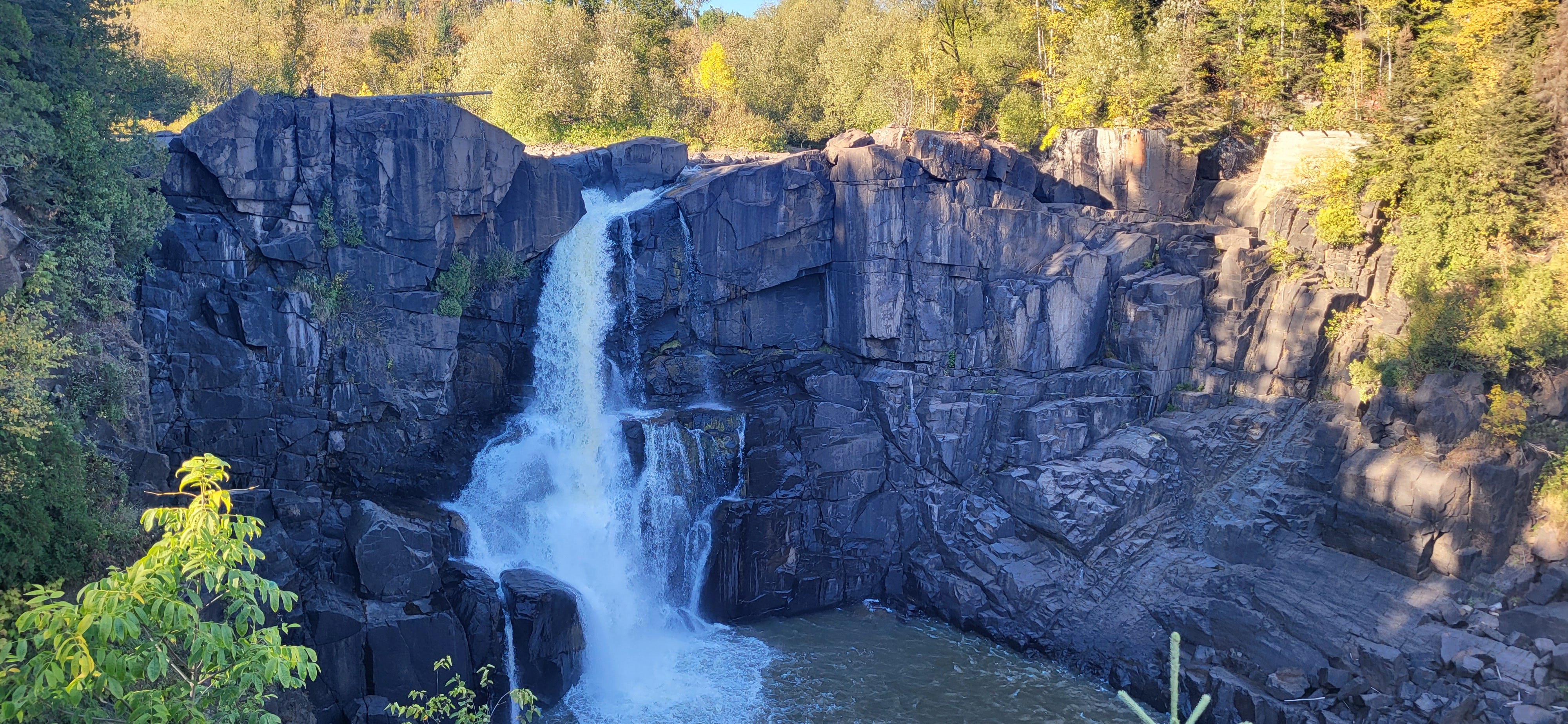
High Falls on the Pigeon River, which forms part of the international border between northwestern Ontario and northeastern Minnesota. Long before it was used by the logging industry, he Pigeon River was an important canoe route for Anishinaabe peoples, and later fur traders. Part of the foundation of the old log flume is visible on the right side of the falls. Photograph by Emily Macgillivray.
Grief, Change, and the Forests that Made Me
In June of 2024—approximately one month before the twenty-fifth anniversary of the blowdown—David Saetre, a professor emeritus at Northland College, told a group of faculty processing profound loss that people feel grief with any unexpected change. About a week after my dad, me, and my students met the tree planters, I learned I was cut from my job at Northland College through the school’s exigency process. I was reeling and grieving in ways I never had in my adult life. But I also gained clarity about how I’d felt in the past: my feelings after the landscape changed suddenly after the blowdown in 1999 were grief.
When my mom and I used to trail ride on the old two-tracks before 1999, we reached a fork and we could either head north toward the river and ride through my favorite section of trail, or we could head west on a narrower trail to the sloughs. If we went west, it felt like riding in a thick green tunnel that was usually filled with swarms of mosquitoes. Viewpoints of the slough itself were limited through the dense bush.
After the blowdown, loggers opened up the landscape around the sloughs, creating roads winding around the shores of the wetland. Even as secession has proceeded, you still get a much wider view of the sloughs—nestled behind Mount Marney and Sun Hill—than before the blowdown.
Directly south, a very wide part of the Whitefish River meanders across the land. For about a decade after the blowdown, there were are a few spots where you could get decent glimpses of this part of the river. It looked like a small lake. These views would have been impossible before the blowdown. Maybe because I never loved this section before 1999, I appreciated the change. I think about what I told my student. In terms of how we feel about landscapes and change over time, “It’s complicated.”
If you don’t head toward the slough at the fork and instead keep heading north, you head down a slope and go through the part of the forest that was my favorite before the blowdown. Soon, you arrive at a much narrower part of the river. After the 1999 blowdown, they stopped logging a few hundred feet from the river at this spot, leaving a short section of the old two-track. A tiny part of the old forest. There are also remnants of an old bridge and a small campsite on the south bank.
In the years following the blowdown, standing there amid some trees that predated the storm, listening to the river flowing in the background, is where I could most clearly remember the version of the forest I loved before July 4, 1999. In the decades following the blowdown, whenever I was in that spot, I felt like I was conjuring up the illusion of ghosts of scenes from forests past.
As an adult, I’m not in this spot often. In fact, it has been years since I’ve visited. But I can still conjure it in mind. I can still feel it. It will change, but I’ll always remember how those trees endured. For me they are a reminder of what was. But they are also a reminder of what we can learn from forests when we take the time to listen.
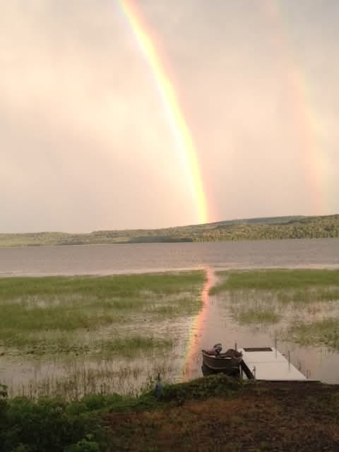
A rainbow over the south shore of Whitefish Lake reflecting on the wild rice beds in front of our camp. Photograph by Emily Macgillivray.
Bibliography
Family diary entries at Whitefish Lake.
Cary J. Griffiths, Gunflint Falling: Blowdown in the Boundary Waters, University of Minnesota Press (2024).
Greg Seitz, “Fourth of July marks 25th anniversary of Boundary Waters Blowdown,” Quetico Superior Wilderness News, July 4, 2024, https://queticosuperior.org/fourth-of-july-marks-20th-anniversary-of-boundary-waters-blowdown/
Dan Kraker, “25 years after Boundary Waters blowdown, a changed forest and vivid memories,” MPR News, July 3, 2024, https://www.mprnews.org/story/2024/07/03/25-years-after-boundary-waters-blowdown-a-changed-forest-and-vivid-memories